You are here: Home > Network List > IU - Global Seismograph Network (GSN - IRIS/USGS) Stations List
> Station PMG Port Moresby, New Guinea > Earthquake Result Viewer
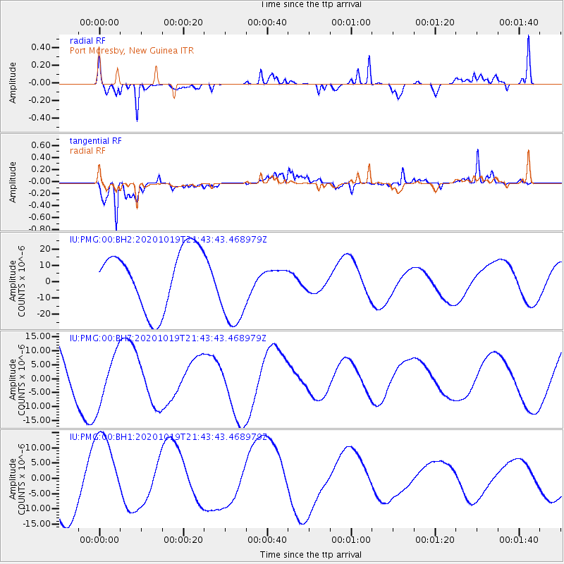
PMG Port Moresby, New Guinea - Earthquake Result Viewer
*The percent match for this event was below the threshold and hence no stack was calculated.
| Earthquake location: |
South Of Alaska |
| Earthquake latitude/longitude: |
54.2/-159.7 |
| Earthquake time(UTC): |
2020/10/19 (293) 21:32:19 GMT |
| Earthquake Depth: |
16 km |
| Earthquake Magnitude: |
5.5 Mww |
| Earthquake Catalog/Contributor: |
NEIC PDE/us |
|
| Network: |
IU Global Seismograph Network (GSN - IRIS/USGS) |
| Station: |
PMG Port Moresby, New Guinea |
| Lat/Lon: |
9.40 S/147.16 E |
| Elevation: |
90 m |
|
| Distance: |
77.5 deg |
| Az: |
233.999 deg |
| Baz: |
28.768 deg |
| Ray Param: |
$rayparam |
*The percent match for this event was below the threshold and hence was not used in the summary stack. |
|
| Radial Match: |
77.72178 % |
| Radial Bump: |
386 |
| Transverse Match: |
88.01105 % |
| Transverse Bump: |
400 |
| SOD ConfigId: |
22732711 |
| Insert Time: |
2020-11-02 22:04:30.942 +0000 |
| GWidth: |
2.5 |
| Max Bumps: |
400 |
| Tol: |
0.001 |
|
Signal To Noise
| Channel | StoN | STA | LTA |
| IU:PMG:00:BHZ:20201019T21:43:43.468979Z | 0.7584577 | 9.038049E-6 | 1.1916352E-5 |
| IU:PMG:00:BH1:20201019T21:43:43.468979Z | 1.254431 | 1.3337881E-5 | 1.0632614E-5 |
| IU:PMG:00:BH2:20201019T21:43:43.468979Z | 1.450906 | 2.6106693E-5 | 1.7993372E-5 |
| Arrivals |
| Ps | |
| PpPs | |
| PsPs/PpSs | |


