You are here: Home > Network List > IU - Global Seismograph Network (GSN - IRIS/USGS) Stations List
> Station RSSD Black Hills, South Dakota, USA > Earthquake Result Viewer
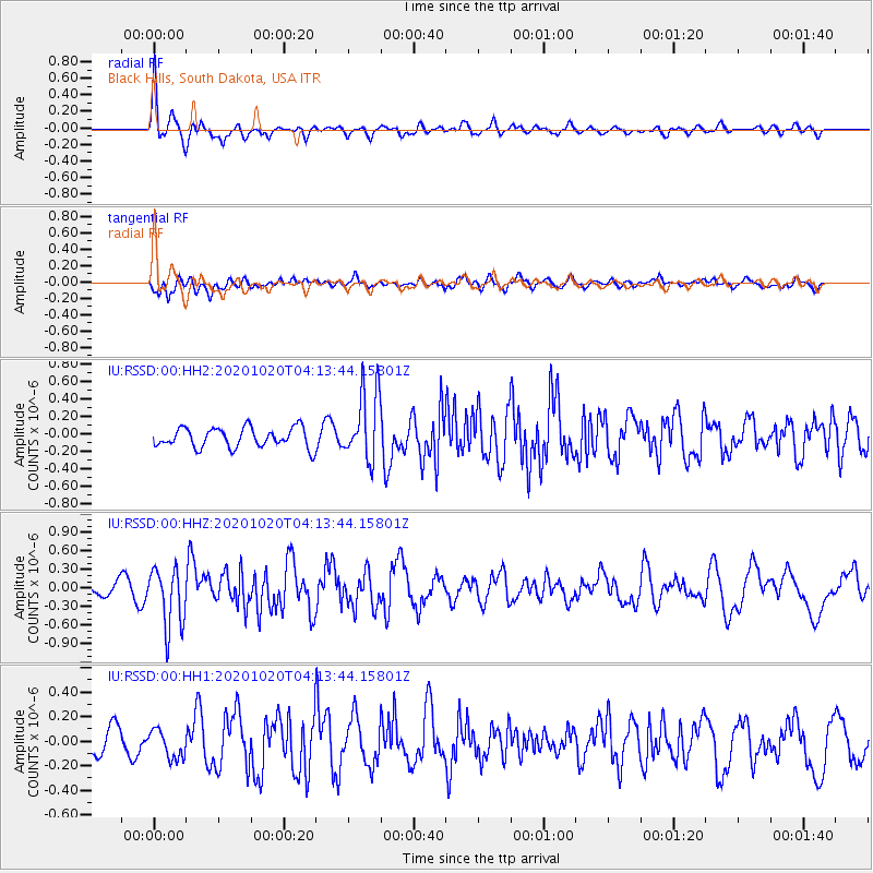
RSSD Black Hills, South Dakota, USA - Earthquake Result Viewer
*The percent match for this event was below the threshold and hence no stack was calculated.
| Earthquake location: |
South Of Alaska |
| Earthquake latitude/longitude: |
54.3/-159.7 |
| Earthquake time(UTC): |
2020/10/20 (294) 04:07:06 GMT |
| Earthquake Depth: |
6.1 km |
| Earthquake Magnitude: |
5.6 mww |
| Earthquake Catalog/Contributor: |
NEIC PDE/us |
|
| Network: |
IU Global Seismograph Network (GSN - IRIS/USGS) |
| Station: |
RSSD Black Hills, South Dakota, USA |
| Lat/Lon: |
44.12 N/104.04 W |
| Elevation: |
2090 m |
|
| Distance: |
36.8 deg |
| Az: |
82.599 deg |
| Baz: |
306.203 deg |
| Ray Param: |
$rayparam |
*The percent match for this event was below the threshold and hence was not used in the summary stack. |
|
| Radial Match: |
61.725735 % |
| Radial Bump: |
400 |
| Transverse Match: |
51.32552 % |
| Transverse Bump: |
400 |
| SOD ConfigId: |
22732711 |
| Insert Time: |
2020-11-03 04:16:26.133 +0000 |
| GWidth: |
2.5 |
| Max Bumps: |
400 |
| Tol: |
0.001 |
|
Signal To Noise
| Channel | StoN | STA | LTA |
| IU:RSSD:00:HHZ:20201020T04:13:44.15801Z | 5.6705675 | 4.814198E-7 | 8.489799E-8 |
| IU:RSSD:00:HH1:20201020T04:13:44.15801Z | 1.3841529 | 1.1684393E-7 | 8.441548E-8 |
| IU:RSSD:00:HH2:20201020T04:13:44.15801Z | 3.498834 | 3.9405958E-7 | 1.1262597E-7 |
| Arrivals |
| Ps | |
| PpPs | |
| PsPs/PpSs | |


