You are here: Home > Network List > US - United States National Seismic Network Stations List
> Station DGMT Dagmar, Montana, USA > Earthquake Result Viewer
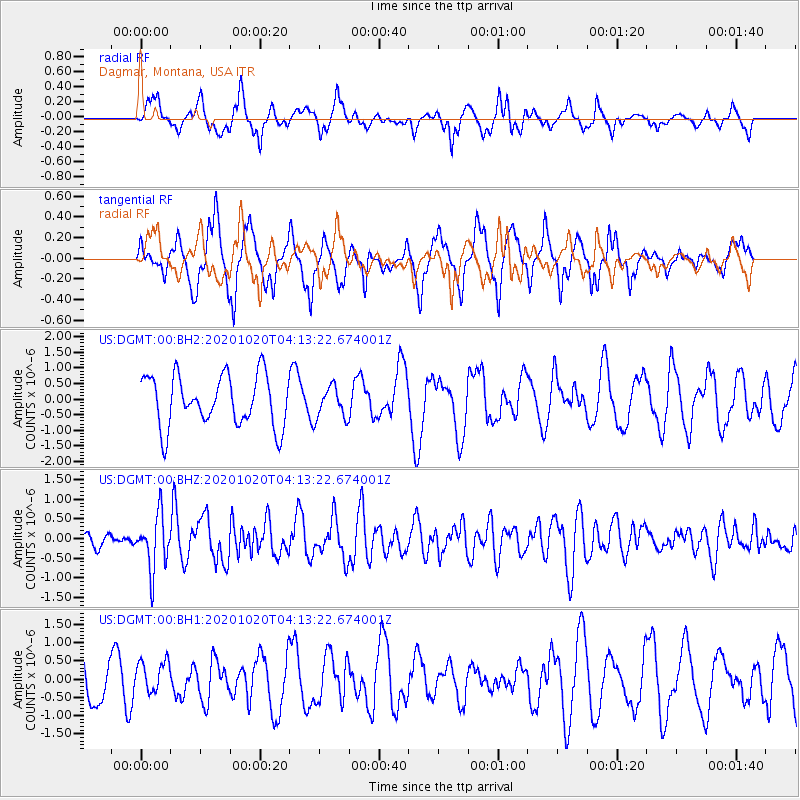
DGMT Dagmar, Montana, USA - Earthquake Result Viewer
*The percent match for this event was below the threshold and hence no stack was calculated.
| Earthquake location: |
South Of Alaska |
| Earthquake latitude/longitude: |
54.3/-159.7 |
| Earthquake time(UTC): |
2020/10/20 (294) 04:07:06 GMT |
| Earthquake Depth: |
6.1 km |
| Earthquake Magnitude: |
5.6 mww |
| Earthquake Catalog/Contributor: |
NEIC PDE/us |
|
| Network: |
US United States National Seismic Network |
| Station: |
DGMT Dagmar, Montana, USA |
| Lat/Lon: |
48.47 N/104.20 W |
| Elevation: |
0.0 m |
|
| Distance: |
34.3 deg |
| Az: |
76.48 deg |
| Baz: |
301.11 deg |
| Ray Param: |
$rayparam |
*The percent match for this event was below the threshold and hence was not used in the summary stack. |
|
| Radial Match: |
64.34889 % |
| Radial Bump: |
400 |
| Transverse Match: |
61.71941 % |
| Transverse Bump: |
337 |
| SOD ConfigId: |
22732711 |
| Insert Time: |
2020-11-03 04:30:05.668 +0000 |
| GWidth: |
2.5 |
| Max Bumps: |
400 |
| Tol: |
0.001 |
|
Signal To Noise
| Channel | StoN | STA | LTA |
| US:DGMT:00:BHZ:20201020T04:13:22.674001Z | 3.6325154 | 6.964142E-7 | 1.9171678E-7 |
| US:DGMT:00:BH1:20201020T04:13:22.674001Z | 0.6318684 | 4.3453684E-7 | 6.8770146E-7 |
| US:DGMT:00:BH2:20201020T04:13:22.674001Z | 0.62667036 | 5.1043975E-7 | 8.1452674E-7 |
| Arrivals |
| Ps | |
| PpPs | |
| PsPs/PpSs | |


