You are here: Home > Network List > US - United States National Seismic Network Stations List
> Station MIAR Mount Ida, Arkansas, USA > Earthquake Result Viewer
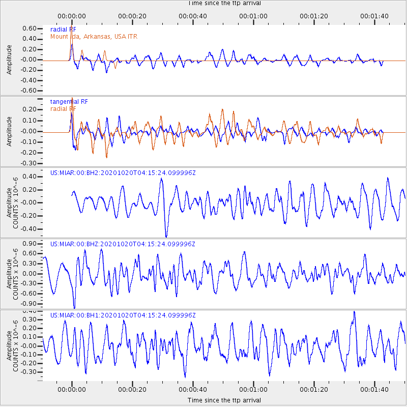
MIAR Mount Ida, Arkansas, USA - Earthquake Result Viewer
*The percent match for this event was below the threshold and hence no stack was calculated.
| Earthquake location: |
South Of Alaska |
| Earthquake latitude/longitude: |
54.3/-159.7 |
| Earthquake time(UTC): |
2020/10/20 (294) 04:07:06 GMT |
| Earthquake Depth: |
6.1 km |
| Earthquake Magnitude: |
5.6 mww |
| Earthquake Catalog/Contributor: |
NEIC PDE/us |
|
| Network: |
US United States National Seismic Network |
| Station: |
MIAR Mount Ida, Arkansas, USA |
| Lat/Lon: |
34.55 N/93.58 W |
| Elevation: |
207 m |
|
| Distance: |
49.2 deg |
| Az: |
85.466 deg |
| Baz: |
314.949 deg |
| Ray Param: |
$rayparam |
*The percent match for this event was below the threshold and hence was not used in the summary stack. |
|
| Radial Match: |
55.61217 % |
| Radial Bump: |
400 |
| Transverse Match: |
66.21489 % |
| Transverse Bump: |
400 |
| SOD ConfigId: |
22732711 |
| Insert Time: |
2020-11-03 04:30:28.185 +0000 |
| GWidth: |
2.5 |
| Max Bumps: |
400 |
| Tol: |
0.001 |
|
Signal To Noise
| Channel | StoN | STA | LTA |
| US:MIAR:00:BHZ:20201020T04:15:24.099996Z | 1.6101439 | 4.832332E-7 | 3.0011802E-7 |
| US:MIAR:00:BH1:20201020T04:15:24.099996Z | 1.3573909 | 1.5408021E-7 | 1.13512044E-7 |
| US:MIAR:00:BH2:20201020T04:15:24.099996Z | 2.4510152 | 2.6925372E-7 | 1.0985395E-7 |
| Arrivals |
| Ps | |
| PpPs | |
| PsPs/PpSs | |


