You are here: Home > Network List > US - United States National Seismic Network Stations List
> Station MNTX Cornudas Mountains, Texas, USA > Earthquake Result Viewer
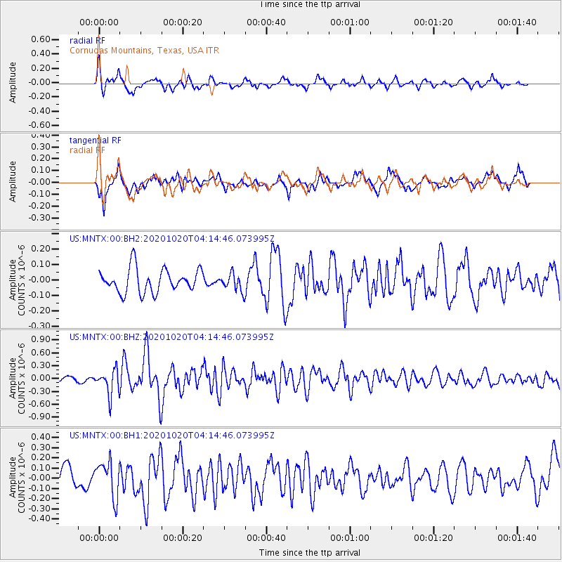
MNTX Cornudas Mountains, Texas, USA - Earthquake Result Viewer
*The percent match for this event was below the threshold and hence no stack was calculated.
| Earthquake location: |
South Of Alaska |
| Earthquake latitude/longitude: |
54.3/-159.7 |
| Earthquake time(UTC): |
2020/10/20 (294) 04:07:06 GMT |
| Earthquake Depth: |
6.1 km |
| Earthquake Magnitude: |
5.6 mww |
| Earthquake Catalog/Contributor: |
NEIC PDE/us |
|
| Network: |
US United States National Seismic Network |
| Station: |
MNTX Cornudas Mountains, Texas, USA |
| Lat/Lon: |
31.70 N/105.38 W |
| Elevation: |
404 m |
|
| Distance: |
44.3 deg |
| Az: |
97.948 deg |
| Baz: |
317.086 deg |
| Ray Param: |
$rayparam |
*The percent match for this event was below the threshold and hence was not used in the summary stack. |
|
| Radial Match: |
78.38796 % |
| Radial Bump: |
400 |
| Transverse Match: |
69.25945 % |
| Transverse Bump: |
400 |
| SOD ConfigId: |
22732711 |
| Insert Time: |
2020-11-03 04:30:29.214 +0000 |
| GWidth: |
2.5 |
| Max Bumps: |
400 |
| Tol: |
0.001 |
|
Signal To Noise
| Channel | StoN | STA | LTA |
| US:MNTX:00:BHZ:20201020T04:14:46.073995Z | 3.669444 | 2.9826384E-7 | 8.128311E-8 |
| US:MNTX:00:BH1:20201020T04:14:46.073995Z | 2.0150988 | 1.7904031E-7 | 8.88494E-8 |
| US:MNTX:00:BH2:20201020T04:14:46.073995Z | 0.7518961 | 5.7690233E-8 | 7.672634E-8 |
| Arrivals |
| Ps | |
| PpPs | |
| PsPs/PpSs | |


