You are here: Home > Network List > US - United States National Seismic Network Stations List
> Station WMOK Wichita Mountains, Oklahoma, USA > Earthquake Result Viewer
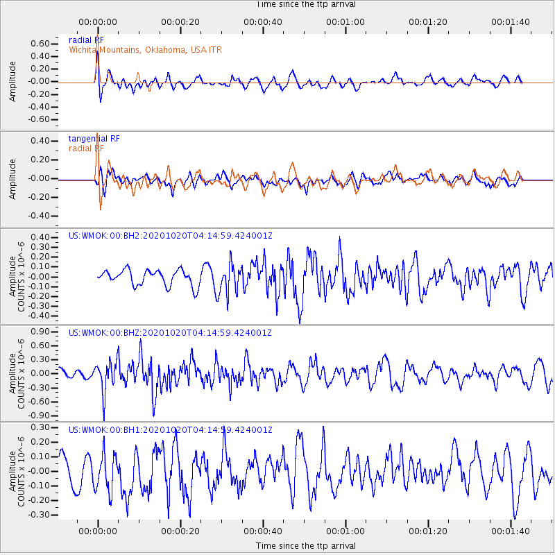
WMOK Wichita Mountains, Oklahoma, USA - Earthquake Result Viewer
*The percent match for this event was below the threshold and hence no stack was calculated.
| Earthquake location: |
South Of Alaska |
| Earthquake latitude/longitude: |
54.3/-159.7 |
| Earthquake time(UTC): |
2020/10/20 (294) 04:07:06 GMT |
| Earthquake Depth: |
6.1 km |
| Earthquake Magnitude: |
5.6 mww |
| Earthquake Catalog/Contributor: |
NEIC PDE/us |
|
| Network: |
US United States National Seismic Network |
| Station: |
WMOK Wichita Mountains, Oklahoma, USA |
| Lat/Lon: |
34.74 N/98.78 W |
| Elevation: |
486 m |
|
| Distance: |
46.0 deg |
| Az: |
89.374 deg |
| Baz: |
314.639 deg |
| Ray Param: |
$rayparam |
*The percent match for this event was below the threshold and hence was not used in the summary stack. |
|
| Radial Match: |
44.49996 % |
| Radial Bump: |
400 |
| Transverse Match: |
42.259064 % |
| Transverse Bump: |
400 |
| SOD ConfigId: |
22732711 |
| Insert Time: |
2020-11-03 04:30:43.929 +0000 |
| GWidth: |
2.5 |
| Max Bumps: |
400 |
| Tol: |
0.001 |
|
Signal To Noise
| Channel | StoN | STA | LTA |
| US:WMOK:00:BHZ:20201020T04:14:59.424001Z | 3.4871573 | 3.239285E-7 | 9.2891845E-8 |
| US:WMOK:00:BH1:20201020T04:14:59.424001Z | 1.2285813 | 1.4391206E-7 | 1.17136786E-7 |
| US:WMOK:00:BH2:20201020T04:14:59.424001Z | 1.8990433 | 1.4925749E-7 | 7.8596145E-8 |
| Arrivals |
| Ps | |
| PpPs | |
| PsPs/PpSs | |


