You are here: Home > Network List > WY - Yellowstone Wyoming Seismic Network Stations List
> Station YHH Holmes Hill, YNP, WY, USA > Earthquake Result Viewer
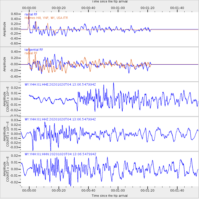
YHH Holmes Hill, YNP, WY, USA - Earthquake Result Viewer
*The percent match for this event was below the threshold and hence no stack was calculated.
| Earthquake location: |
South Of Alaska |
| Earthquake latitude/longitude: |
54.3/-159.7 |
| Earthquake time(UTC): |
2020/10/20 (294) 04:07:06 GMT |
| Earthquake Depth: |
6.1 km |
| Earthquake Magnitude: |
5.6 mww |
| Earthquake Catalog/Contributor: |
NEIC PDE/us |
|
| Network: |
WY Yellowstone Wyoming Seismic Network |
| Station: |
YHH Holmes Hill, YNP, WY, USA |
| Lat/Lon: |
44.79 N/110.85 W |
| Elevation: |
2717 m |
|
| Distance: |
32.5 deg |
| Az: |
86.624 deg |
| Baz: |
304.759 deg |
| Ray Param: |
$rayparam |
*The percent match for this event was below the threshold and hence was not used in the summary stack. |
|
| Radial Match: |
65.70402 % |
| Radial Bump: |
400 |
| Transverse Match: |
69.15182 % |
| Transverse Bump: |
400 |
| SOD ConfigId: |
22732711 |
| Insert Time: |
2020-11-03 04:32:34.197 +0000 |
| GWidth: |
2.5 |
| Max Bumps: |
400 |
| Tol: |
0.001 |
|
Signal To Noise
| Channel | StoN | STA | LTA |
| WY:YHH:01:HHZ:20201020T04:13:06.547994Z | 3.2820032 | 1.1487329E-8 | 3.5000969E-9 |
| WY:YHH:01:HHN:20201020T04:13:06.547994Z | 1.0372546 | 5.23012E-9 | 5.042272E-9 |
| WY:YHH:01:HHE:20201020T04:13:06.547994Z | 1.9506522 | 7.570544E-9 | 3.881032E-9 |
| Arrivals |
| Ps | |
| PpPs | |
| PsPs/PpSs | |


