You are here: Home > Network List > TA - USArray Transportable Network (new EarthScope stations) Stations List
> Station G31M Satah River, YT, CAN > Earthquake Result Viewer
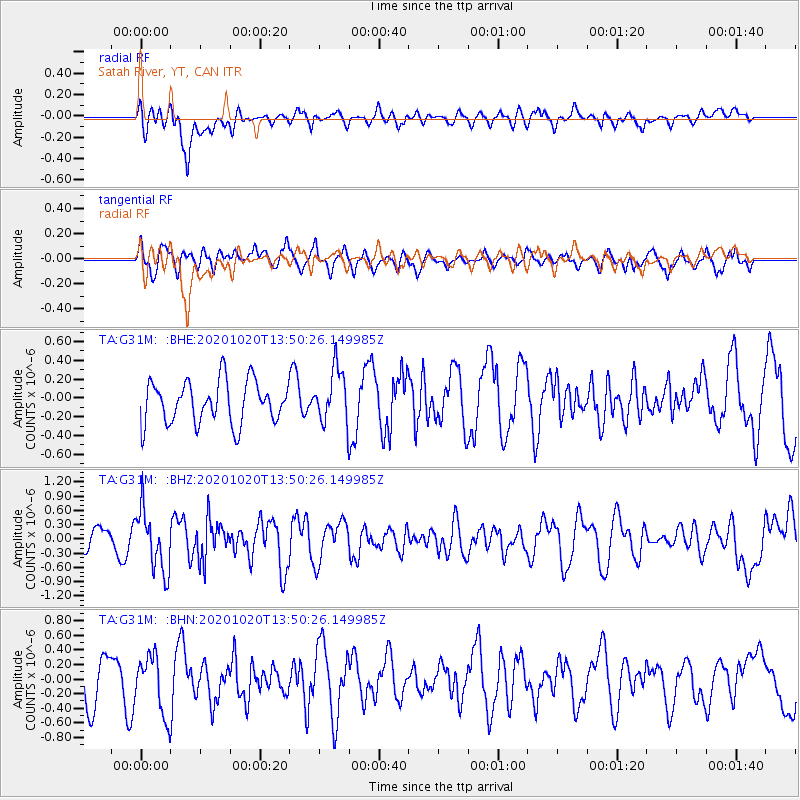
G31M Satah River, YT, CAN - Earthquake Result Viewer
*The percent match for this event was below the threshold and hence no stack was calculated.
| Earthquake location: |
Iceland |
| Earthquake latitude/longitude: |
64.0/-22.1 |
| Earthquake time(UTC): |
2020/10/20 (294) 13:43:17 GMT |
| Earthquake Depth: |
10 km |
| Earthquake Magnitude: |
5.6 mww |
| Earthquake Catalog/Contributor: |
NEIC PDE/us |
|
| Network: |
TA USArray Transportable Network (new EarthScope stations) |
| Station: |
G31M Satah River, YT, CAN |
| Lat/Lon: |
66.92 N/134.27 W |
| Elevation: |
61 m |
|
| Distance: |
40.6 deg |
| Az: |
325.84 deg |
| Baz: |
38.869 deg |
| Ray Param: |
$rayparam |
*The percent match for this event was below the threshold and hence was not used in the summary stack. |
|
| Radial Match: |
64.33844 % |
| Radial Bump: |
400 |
| Transverse Match: |
55.456745 % |
| Transverse Bump: |
400 |
| SOD ConfigId: |
22732711 |
| Insert Time: |
2020-11-03 14:01:48.810 +0000 |
| GWidth: |
2.5 |
| Max Bumps: |
400 |
| Tol: |
0.001 |
|
Signal To Noise
| Channel | StoN | STA | LTA |
| TA:G31M: :BHZ:20201020T13:50:26.149985Z | 3.0431542 | 6.447651E-7 | 2.1187395E-7 |
| TA:G31M: :BHN:20201020T13:50:26.149985Z | 1.3663751 | 4.015098E-7 | 2.9385035E-7 |
| TA:G31M: :BHE:20201020T13:50:26.149985Z | 1.2736692 | 2.8624314E-7 | 2.2473898E-7 |
| Arrivals |
| Ps | |
| PpPs | |
| PsPs/PpSs | |


