You are here: Home > Network List > US - United States National Seismic Network Stations List
> Station DUG Dugway, Tooele County, Utah, USA > Earthquake Result Viewer
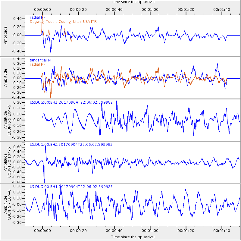
DUG Dugway, Tooele County, Utah, USA - Earthquake Result Viewer
*The percent match for this event was below the threshold and hence no stack was calculated.
| Earthquake location: |
Near Coast Of Northern Chile |
| Earthquake latitude/longitude: |
-19.3/-70.0 |
| Earthquake time(UTC): |
2017/09/04 (247) 21:55:20 GMT |
| Earthquake Depth: |
63 km |
| Earthquake Magnitude: |
5.1 Mwr |
| Earthquake Catalog/Contributor: |
NEIC PDE/us |
|
| Network: |
US United States National Seismic Network |
| Station: |
DUG Dugway, Tooele County, Utah, USA |
| Lat/Lon: |
40.19 N/112.81 W |
| Elevation: |
1477 m |
|
| Distance: |
71.3 deg |
| Az: |
326.696 deg |
| Baz: |
137.386 deg |
| Ray Param: |
$rayparam |
*The percent match for this event was below the threshold and hence was not used in the summary stack. |
|
| Radial Match: |
55.719864 % |
| Radial Bump: |
400 |
| Transverse Match: |
69.819435 % |
| Transverse Bump: |
400 |
| SOD ConfigId: |
2307692 |
| Insert Time: |
2017-09-18 21:59:26.287 +0000 |
| GWidth: |
2.5 |
| Max Bumps: |
400 |
| Tol: |
0.001 |
|
Signal To Noise
| Channel | StoN | STA | LTA |
| US:DUG:00:BHZ:20170904T22:06:02.59998Z | 3.261172 | 2.7499675E-7 | 8.432452E-8 |
| US:DUG:00:BH1:20170904T22:06:02.59998Z | 1.2859402 | 1.06615836E-7 | 8.290887E-8 |
| US:DUG:00:BH2:20170904T22:06:02.59998Z | 1.4423417 | 1.3664985E-7 | 9.474166E-8 |
| Arrivals |
| Ps | |
| PpPs | |
| PsPs/PpSs | |


