You are here: Home > Network List > US - United States National Seismic Network Stations List
> Station LKWY Lake (Yellowstone--Lake), Wyoming, USA > Earthquake Result Viewer
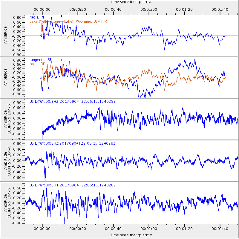
LKWY Lake (Yellowstone--Lake), Wyoming, USA - Earthquake Result Viewer
*The percent match for this event was below the threshold and hence no stack was calculated.
| Earthquake location: |
Near Coast Of Northern Chile |
| Earthquake latitude/longitude: |
-19.3/-70.0 |
| Earthquake time(UTC): |
2017/09/04 (247) 21:55:20 GMT |
| Earthquake Depth: |
63 km |
| Earthquake Magnitude: |
5.1 Mwr |
| Earthquake Catalog/Contributor: |
NEIC PDE/us |
|
| Network: |
US United States National Seismic Network |
| Station: |
LKWY Lake (Yellowstone--Lake), Wyoming, USA |
| Lat/Lon: |
44.57 N/110.40 W |
| Elevation: |
2424 m |
|
| Distance: |
73.5 deg |
| Az: |
331.122 deg |
| Baz: |
140.347 deg |
| Ray Param: |
$rayparam |
*The percent match for this event was below the threshold and hence was not used in the summary stack. |
|
| Radial Match: |
41.383514 % |
| Radial Bump: |
400 |
| Transverse Match: |
42.763332 % |
| Transverse Bump: |
400 |
| SOD ConfigId: |
2307692 |
| Insert Time: |
2017-09-18 21:59:46.251 +0000 |
| GWidth: |
2.5 |
| Max Bumps: |
400 |
| Tol: |
0.001 |
|
Signal To Noise
| Channel | StoN | STA | LTA |
| US:LKWY:00:BHZ:20170904T22:06:15.124028Z | 2.4511836 | 2.472982E-7 | 1.0088931E-7 |
| US:LKWY:00:BH1:20170904T22:06:15.124028Z | 1.9920136 | 3.124336E-7 | 1.5684311E-7 |
| US:LKWY:00:BH2:20170904T22:06:15.124028Z | 1.4794183 | 4.5273654E-7 | 3.0602334E-7 |
| Arrivals |
| Ps | |
| PpPs | |
| PsPs/PpSs | |


