You are here: Home > Network List > AZ - ANZA Regional Network Stations List
> Station FRD AZ.FRD > Earthquake Result Viewer
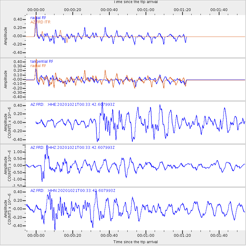
FRD AZ.FRD - Earthquake Result Viewer
*The percent match for this event was below the threshold and hence no stack was calculated.
| Earthquake location: |
Tonga Islands Region |
| Earthquake latitude/longitude: |
-19.3/-172.4 |
| Earthquake time(UTC): |
2020/10/21 (295) 00:22:33 GMT |
| Earthquake Depth: |
10 km |
| Earthquake Magnitude: |
5.9 mww |
| Earthquake Catalog/Contributor: |
NEIC PDE/us |
|
| Network: |
AZ ANZA Regional Network |
| Station: |
FRD AZ.FRD |
| Lat/Lon: |
33.49 N/116.60 W |
| Elevation: |
1164 m |
|
| Distance: |
74.7 deg |
| Az: |
45.747 deg |
| Baz: |
234.044 deg |
| Ray Param: |
$rayparam |
*The percent match for this event was below the threshold and hence was not used in the summary stack. |
|
| Radial Match: |
79.02667 % |
| Radial Bump: |
400 |
| Transverse Match: |
72.94496 % |
| Transverse Bump: |
400 |
| SOD ConfigId: |
22732711 |
| Insert Time: |
2020-11-04 00:31:11.335 +0000 |
| GWidth: |
2.5 |
| Max Bumps: |
400 |
| Tol: |
0.001 |
|
Signal To Noise
| Channel | StoN | STA | LTA |
| AZ:FRD: :HHZ:20201021T00:33:42.607993Z | 4.550781 | 4.16333E-7 | 9.148606E-8 |
| AZ:FRD: :HHN:20201021T00:33:42.607993Z | 1.5147383 | 1.3102986E-7 | 8.650329E-8 |
| AZ:FRD: :HHE:20201021T00:33:42.607993Z | 3.7502465 | 2.0315738E-7 | 5.4171746E-8 |
| Arrivals |
| Ps | |
| PpPs | |
| PsPs/PpSs | |


