You are here: Home > Network List > CI - Caltech Regional Seismic Network Stations List
> Station DGR Domenigoni Reservoir, California, USA > Earthquake Result Viewer
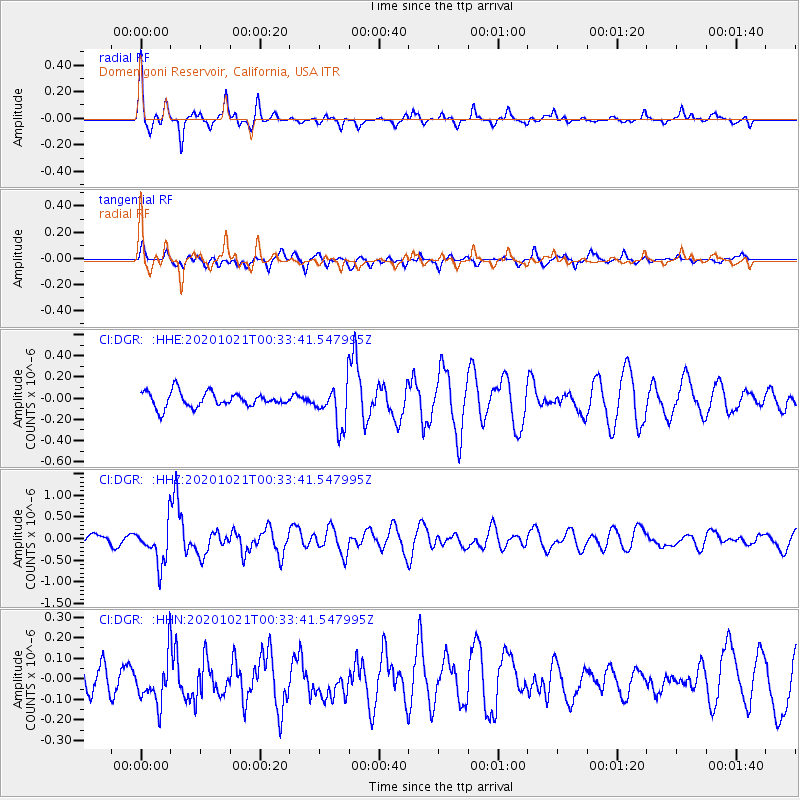
DGR Domenigoni Reservoir, California, USA - Earthquake Result Viewer
*The percent match for this event was below the threshold and hence no stack was calculated.
| Earthquake location: |
Tonga Islands Region |
| Earthquake latitude/longitude: |
-19.3/-172.4 |
| Earthquake time(UTC): |
2020/10/21 (295) 00:22:33 GMT |
| Earthquake Depth: |
10 km |
| Earthquake Magnitude: |
5.9 mww |
| Earthquake Catalog/Contributor: |
NEIC PDE/us |
|
| Network: |
CI Caltech Regional Seismic Network |
| Station: |
DGR Domenigoni Reservoir, California, USA |
| Lat/Lon: |
33.65 N/117.01 W |
| Elevation: |
609 m |
|
| Distance: |
74.6 deg |
| Az: |
45.409 deg |
| Baz: |
233.731 deg |
| Ray Param: |
$rayparam |
*The percent match for this event was below the threshold and hence was not used in the summary stack. |
|
| Radial Match: |
78.771225 % |
| Radial Bump: |
370 |
| Transverse Match: |
75.406845 % |
| Transverse Bump: |
400 |
| SOD ConfigId: |
22732711 |
| Insert Time: |
2020-11-04 00:33:59.897 +0000 |
| GWidth: |
2.5 |
| Max Bumps: |
400 |
| Tol: |
0.001 |
|
Signal To Noise
| Channel | StoN | STA | LTA |
| CI:DGR: :HHZ:20201021T00:33:41.547995Z | 5.8376684 | 4.5523146E-7 | 7.7981724E-8 |
| CI:DGR: :HHN:20201021T00:33:41.547995Z | 1.6629541 | 1.10758805E-7 | 6.660365E-8 |
| CI:DGR: :HHE:20201021T00:33:41.547995Z | 2.7295175 | 1.9263251E-7 | 7.057383E-8 |
| Arrivals |
| Ps | |
| PpPs | |
| PsPs/PpSs | |


