You are here: Home > Network List > CI - Caltech Regional Seismic Network Stations List
> Station SLA SLA, Trona, CA, USA > Earthquake Result Viewer
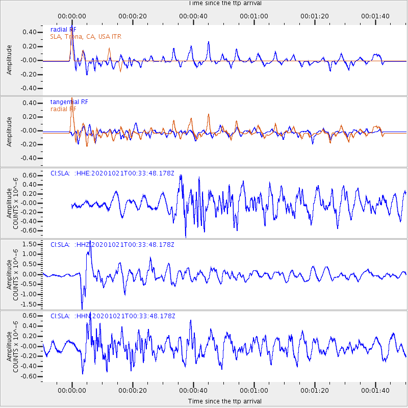
SLA SLA, Trona, CA, USA - Earthquake Result Viewer
*The percent match for this event was below the threshold and hence no stack was calculated.
| Earthquake location: |
Tonga Islands Region |
| Earthquake latitude/longitude: |
-19.3/-172.4 |
| Earthquake time(UTC): |
2020/10/21 (295) 00:22:33 GMT |
| Earthquake Depth: |
10 km |
| Earthquake Magnitude: |
5.9 mww |
| Earthquake Catalog/Contributor: |
NEIC PDE/us |
|
| Network: |
CI Caltech Regional Seismic Network |
| Station: |
SLA SLA, Trona, CA, USA |
| Lat/Lon: |
35.89 N/117.28 W |
| Elevation: |
1174 m |
|
| Distance: |
75.7 deg |
| Az: |
43.413 deg |
| Baz: |
233.063 deg |
| Ray Param: |
$rayparam |
*The percent match for this event was below the threshold and hence was not used in the summary stack. |
|
| Radial Match: |
73.76903 % |
| Radial Bump: |
400 |
| Transverse Match: |
74.65699 % |
| Transverse Bump: |
400 |
| SOD ConfigId: |
22732711 |
| Insert Time: |
2020-11-04 00:34:50.557 +0000 |
| GWidth: |
2.5 |
| Max Bumps: |
400 |
| Tol: |
0.001 |
|
Signal To Noise
| Channel | StoN | STA | LTA |
| CI:SLA: :HHZ:20201021T00:33:48.178Z | 6.374787 | 5.7032014E-7 | 8.946497E-8 |
| CI:SLA: :HHN:20201021T00:33:48.178Z | 1.7796056 | 1.9486225E-7 | 1.09497435E-7 |
| CI:SLA: :HHE:20201021T00:33:48.178Z | 1.8920647 | 1.976575E-7 | 1.04466565E-7 |
| Arrivals |
| Ps | |
| PpPs | |
| PsPs/PpSs | |


