You are here: Home > Network List > CI - Caltech Regional Seismic Network Stations List
> Station SMM Simmler, CA, USA > Earthquake Result Viewer
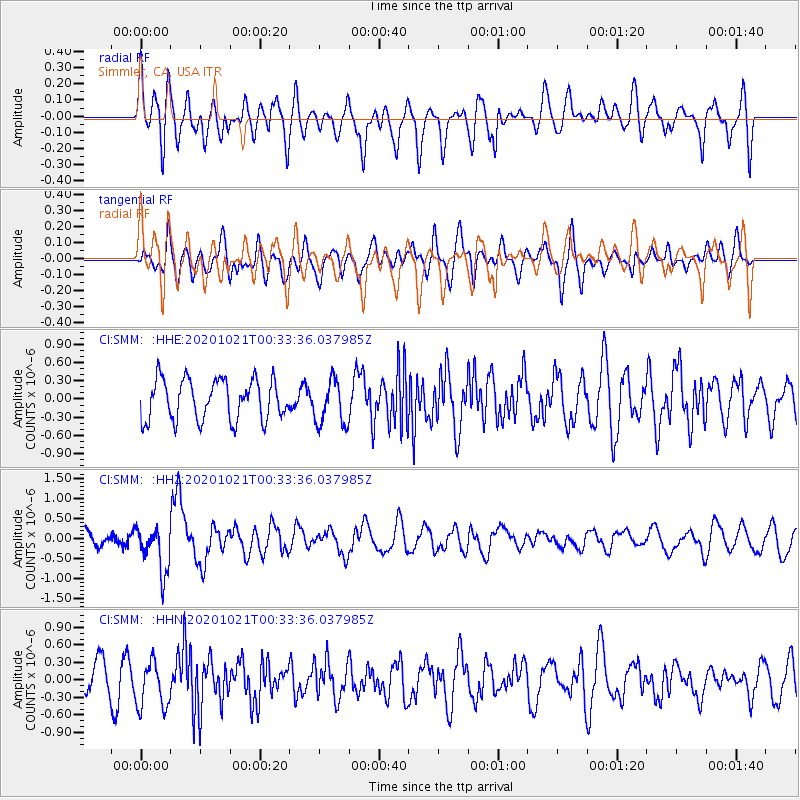
SMM Simmler, CA, USA - Earthquake Result Viewer
*The percent match for this event was below the threshold and hence no stack was calculated.
| Earthquake location: |
Tonga Islands Region |
| Earthquake latitude/longitude: |
-19.3/-172.4 |
| Earthquake time(UTC): |
2020/10/21 (295) 00:22:33 GMT |
| Earthquake Depth: |
10 km |
| Earthquake Magnitude: |
5.9 mww |
| Earthquake Catalog/Contributor: |
NEIC PDE/us |
|
| Network: |
CI Caltech Regional Seismic Network |
| Station: |
SMM Simmler, CA, USA |
| Lat/Lon: |
35.31 N/120.00 W |
| Elevation: |
599 m |
|
| Distance: |
73.6 deg |
| Az: |
42.478 deg |
| Baz: |
231.243 deg |
| Ray Param: |
$rayparam |
*The percent match for this event was below the threshold and hence was not used in the summary stack. |
|
| Radial Match: |
55.104004 % |
| Radial Bump: |
400 |
| Transverse Match: |
51.730305 % |
| Transverse Bump: |
400 |
| SOD ConfigId: |
22732711 |
| Insert Time: |
2020-11-04 00:34:54.813 +0000 |
| GWidth: |
2.5 |
| Max Bumps: |
400 |
| Tol: |
0.001 |
|
Signal To Noise
| Channel | StoN | STA | LTA |
| CI:SMM: :HHZ:20201021T00:33:36.037985Z | 3.4677854 | 5.7332124E-7 | 1.6532778E-7 |
| CI:SMM: :HHN:20201021T00:33:36.037985Z | 1.7666613 | 4.0521456E-7 | 2.2936743E-7 |
| CI:SMM: :HHE:20201021T00:33:36.037985Z | 1.1201051 | 3.705004E-7 | 3.3077288E-7 |
| Arrivals |
| Ps | |
| PpPs | |
| PsPs/PpSs | |


