You are here: Home > Network List > CN - Canadian National Seismograph Network Stations List
> Station INK INUVIK, NT > Earthquake Result Viewer
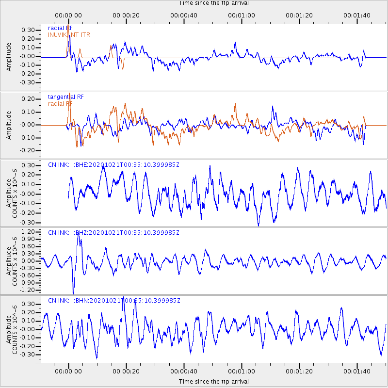
INK INUVIK, NT - Earthquake Result Viewer
*The percent match for this event was below the threshold and hence no stack was calculated.
| Earthquake location: |
Tonga Islands Region |
| Earthquake latitude/longitude: |
-19.3/-172.4 |
| Earthquake time(UTC): |
2020/10/21 (295) 00:22:33 GMT |
| Earthquake Depth: |
10 km |
| Earthquake Magnitude: |
5.9 mww |
| Earthquake Catalog/Contributor: |
NEIC PDE/us |
|
| Network: |
CN Canadian National Seismograph Network |
| Station: |
INK INUVIK, NT |
| Lat/Lon: |
68.31 N/133.53 W |
| Elevation: |
44 m |
|
| Distance: |
91.8 deg |
| Az: |
13.497 deg |
| Baz: |
216.36 deg |
| Ray Param: |
$rayparam |
*The percent match for this event was below the threshold and hence was not used in the summary stack. |
|
| Radial Match: |
55.84984 % |
| Radial Bump: |
400 |
| Transverse Match: |
37.152008 % |
| Transverse Bump: |
400 |
| SOD ConfigId: |
22732711 |
| Insert Time: |
2020-11-04 00:35:43.444 +0000 |
| GWidth: |
2.5 |
| Max Bumps: |
400 |
| Tol: |
0.001 |
|
Signal To Noise
| Channel | StoN | STA | LTA |
| CN:INK: :BHZ:20201021T00:35:10.399985Z | 6.349438 | 6.501616E-7 | 1.0239672E-7 |
| CN:INK: :BHN:20201021T00:35:10.399985Z | 0.94527185 | 1.0577551E-7 | 1.11899574E-7 |
| CN:INK: :BHE:20201021T00:35:10.399985Z | 1.325802 | 1.4430226E-7 | 1.0884148E-7 |
| Arrivals |
| Ps | |
| PpPs | |
| PsPs/PpSs | |


