You are here: Home > Network List > IU - Global Seismograph Network (GSN - IRIS/USGS) Stations List
> Station PMG Port Moresby, New Guinea > Earthquake Result Viewer
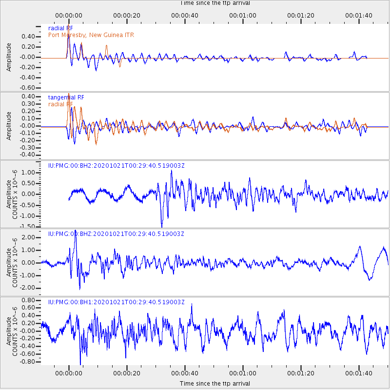
PMG Port Moresby, New Guinea - Earthquake Result Viewer
*The percent match for this event was below the threshold and hence no stack was calculated.
| Earthquake location: |
Tonga Islands Region |
| Earthquake latitude/longitude: |
-19.3/-172.4 |
| Earthquake time(UTC): |
2020/10/21 (295) 00:22:33 GMT |
| Earthquake Depth: |
10 km |
| Earthquake Magnitude: |
5.9 mww |
| Earthquake Catalog/Contributor: |
NEIC PDE/us |
|
| Network: |
IU Global Seismograph Network (GSN - IRIS/USGS) |
| Station: |
PMG Port Moresby, New Guinea |
| Lat/Lon: |
9.40 S/147.16 E |
| Elevation: |
90 m |
|
| Distance: |
40.3 deg |
| Az: |
278.319 deg |
| Baz: |
108.736 deg |
| Ray Param: |
$rayparam |
*The percent match for this event was below the threshold and hence was not used in the summary stack. |
|
| Radial Match: |
81.82689 % |
| Radial Bump: |
400 |
| Transverse Match: |
71.322655 % |
| Transverse Bump: |
400 |
| SOD ConfigId: |
22732711 |
| Insert Time: |
2020-11-04 00:38:37.832 +0000 |
| GWidth: |
2.5 |
| Max Bumps: |
400 |
| Tol: |
0.001 |
|
Signal To Noise
| Channel | StoN | STA | LTA |
| IU:PMG:00:BHZ:20201021T00:29:40.519003Z | 4.517918 | 1.0897728E-6 | 2.4121127E-7 |
| IU:PMG:00:BH1:20201021T00:29:40.519003Z | 2.6013453 | 3.0809528E-7 | 1.18436894E-7 |
| IU:PMG:00:BH2:20201021T00:29:40.519003Z | 2.8380663 | 5.74562E-7 | 2.024484E-7 |
| Arrivals |
| Ps | |
| PpPs | |
| PsPs/PpSs | |


