You are here: Home > Network List > IW - Intermountain West Stations List
> Station DLMT Dillon, Montana, USA > Earthquake Result Viewer
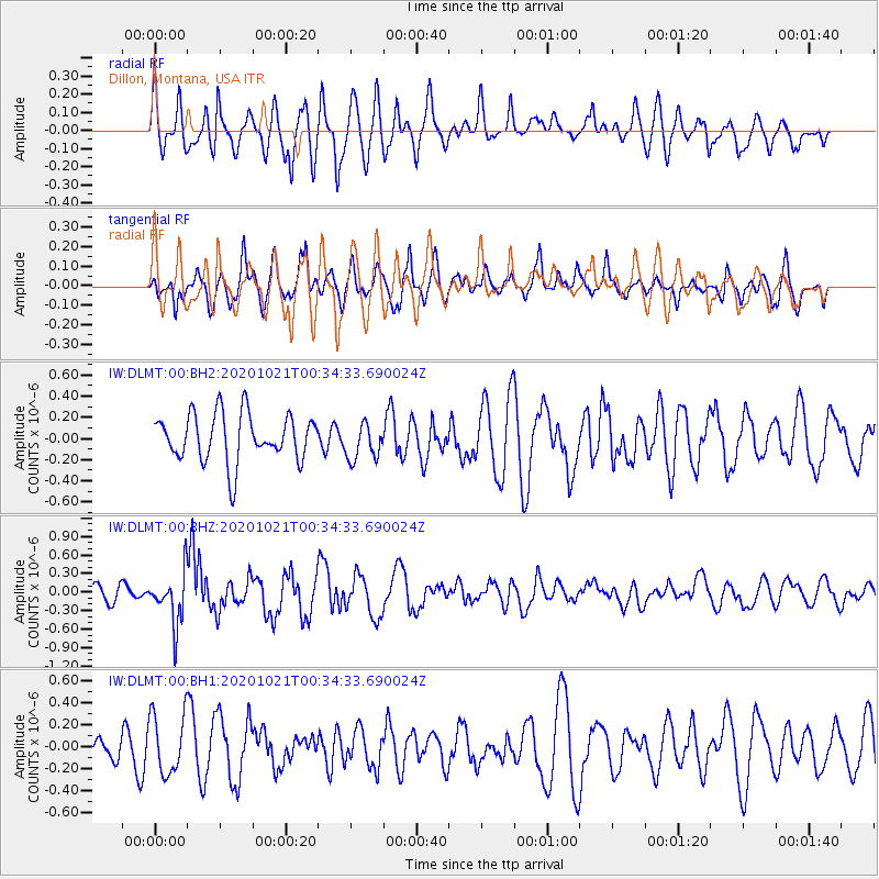
DLMT Dillon, Montana, USA - Earthquake Result Viewer
*The percent match for this event was below the threshold and hence no stack was calculated.
| Earthquake location: |
Tonga Islands Region |
| Earthquake latitude/longitude: |
-19.3/-172.4 |
| Earthquake time(UTC): |
2020/10/21 (295) 00:22:33 GMT |
| Earthquake Depth: |
10 km |
| Earthquake Magnitude: |
5.9 mww |
| Earthquake Catalog/Contributor: |
NEIC PDE/us |
|
| Network: |
IW Intermountain West |
| Station: |
DLMT Dillon, Montana, USA |
| Lat/Lon: |
45.36 N/112.60 W |
| Elevation: |
1569 m |
|
| Distance: |
84.2 deg |
| Az: |
37.767 deg |
| Baz: |
235.125 deg |
| Ray Param: |
$rayparam |
*The percent match for this event was below the threshold and hence was not used in the summary stack. |
|
| Radial Match: |
66.69169 % |
| Radial Bump: |
400 |
| Transverse Match: |
55.83075 % |
| Transverse Bump: |
400 |
| SOD ConfigId: |
22732711 |
| Insert Time: |
2020-11-04 00:38:46.830 +0000 |
| GWidth: |
2.5 |
| Max Bumps: |
400 |
| Tol: |
0.001 |
|
Signal To Noise
| Channel | StoN | STA | LTA |
| IW:DLMT:00:BHZ:20201021T00:34:33.690024Z | 3.8271499 | 4.1115445E-7 | 1.0743098E-7 |
| IW:DLMT:00:BH1:20201021T00:34:33.690024Z | 2.046615 | 2.7295332E-7 | 1.3336819E-7 |
| IW:DLMT:00:BH2:20201021T00:34:33.690024Z | 0.77415746 | 1.7475612E-7 | 2.2573718E-7 |
| Arrivals |
| Ps | |
| PpPs | |
| PsPs/PpSs | |


