You are here: Home > Network List > TA - USArray Transportable Network (new EarthScope stations) Stations List
> Station E20K Nigu River, AK, USA > Earthquake Result Viewer
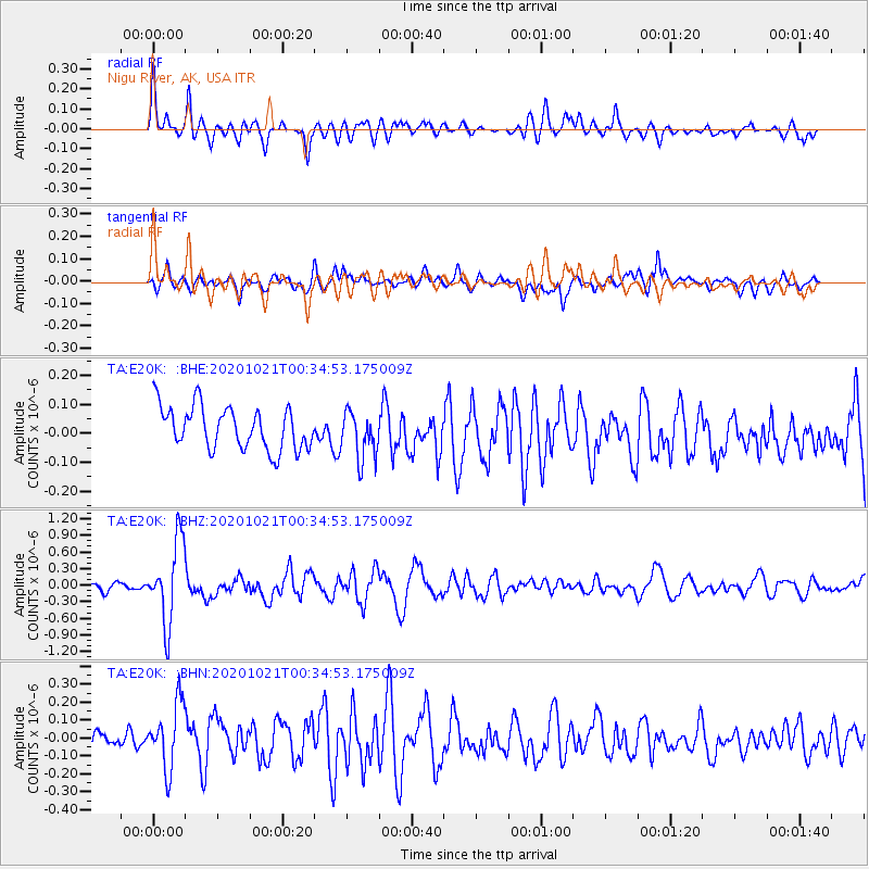
E20K Nigu River, AK, USA - Earthquake Result Viewer
*The percent match for this event was below the threshold and hence no stack was calculated.
| Earthquake location: |
Tonga Islands Region |
| Earthquake latitude/longitude: |
-19.3/-172.4 |
| Earthquake time(UTC): |
2020/10/21 (295) 00:22:33 GMT |
| Earthquake Depth: |
10 km |
| Earthquake Magnitude: |
5.9 mww |
| Earthquake Catalog/Contributor: |
NEIC PDE/us |
|
| Network: |
TA USArray Transportable Network (new EarthScope stations) |
| Station: |
E20K Nigu River, AK, USA |
| Lat/Lon: |
68.26 N/156.19 W |
| Elevation: |
866 m |
|
| Distance: |
88.1 deg |
| Az: |
5.97 deg |
| Baz: |
195.285 deg |
| Ray Param: |
$rayparam |
*The percent match for this event was below the threshold and hence was not used in the summary stack. |
|
| Radial Match: |
79.092545 % |
| Radial Bump: |
400 |
| Transverse Match: |
64.16069 % |
| Transverse Bump: |
400 |
| SOD ConfigId: |
22732711 |
| Insert Time: |
2020-11-04 00:45:24.008 +0000 |
| GWidth: |
2.5 |
| Max Bumps: |
400 |
| Tol: |
0.001 |
|
Signal To Noise
| Channel | StoN | STA | LTA |
| TA:E20K: :BHZ:20201021T00:34:53.175009Z | 10.655696 | 7.343951E-7 | 6.892042E-8 |
| TA:E20K: :BHN:20201021T00:34:53.175009Z | 4.7075214 | 1.8585021E-7 | 3.9479417E-8 |
| TA:E20K: :BHE:20201021T00:34:53.175009Z | 1.1126589 | 8.170364E-8 | 7.343099E-8 |
| Arrivals |
| Ps | |
| PpPs | |
| PsPs/PpSs | |


