You are here: Home > Network List > US - United States National Seismic Network Stations List
> Station MSO Missoula, Montana, USA > Earthquake Result Viewer
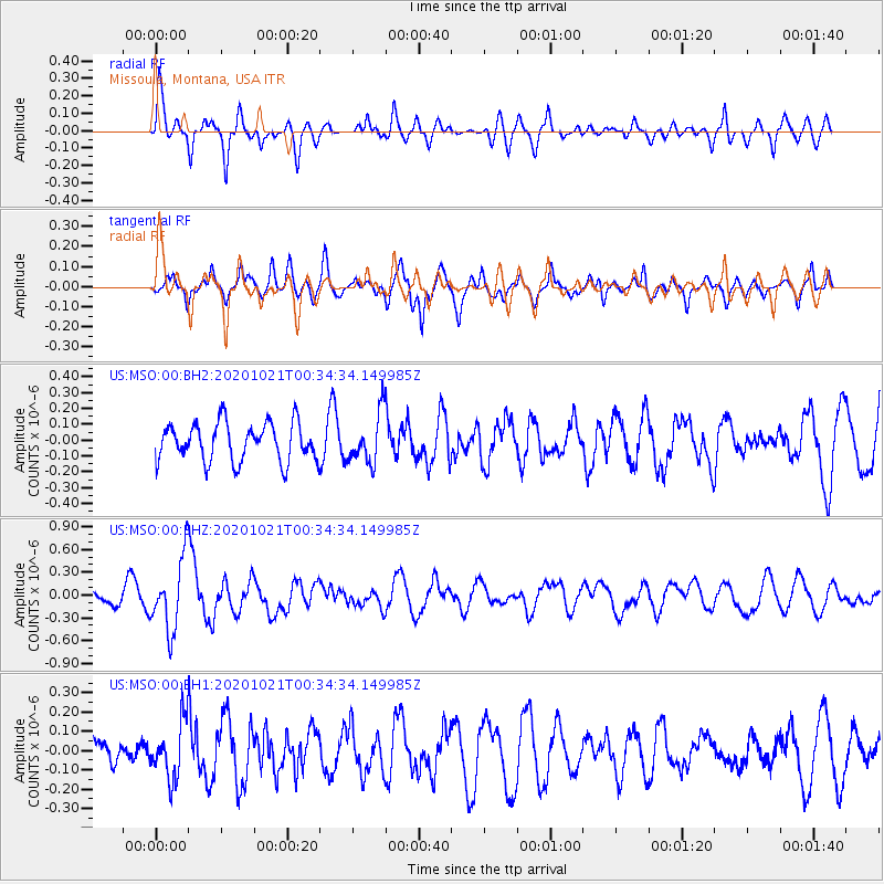
MSO Missoula, Montana, USA - Earthquake Result Viewer
*The percent match for this event was below the threshold and hence no stack was calculated.
| Earthquake location: |
Tonga Islands Region |
| Earthquake latitude/longitude: |
-19.3/-172.4 |
| Earthquake time(UTC): |
2020/10/21 (295) 00:22:33 GMT |
| Earthquake Depth: |
10 km |
| Earthquake Magnitude: |
5.9 mww |
| Earthquake Catalog/Contributor: |
NEIC PDE/us |
|
| Network: |
US United States National Seismic Network |
| Station: |
MSO Missoula, Montana, USA |
| Lat/Lon: |
46.83 N/113.94 W |
| Elevation: |
1264 m |
|
| Distance: |
84.2 deg |
| Az: |
36.02 deg |
| Baz: |
233.983 deg |
| Ray Param: |
$rayparam |
*The percent match for this event was below the threshold and hence was not used in the summary stack. |
|
| Radial Match: |
61.699215 % |
| Radial Bump: |
400 |
| Transverse Match: |
67.5474 % |
| Transverse Bump: |
353 |
| SOD ConfigId: |
22732711 |
| Insert Time: |
2020-11-04 00:50:11.756 +0000 |
| GWidth: |
2.5 |
| Max Bumps: |
400 |
| Tol: |
0.001 |
|
Signal To Noise
| Channel | StoN | STA | LTA |
| US:MSO:00:BHZ:20201021T00:34:34.149985Z | 4.806574 | 4.7539655E-7 | 9.8905495E-8 |
| US:MSO:00:BH1:20201021T00:34:34.149985Z | 1.1877615 | 1.4966257E-7 | 1.2600388E-7 |
| US:MSO:00:BH2:20201021T00:34:34.149985Z | 1.2960379 | 1.5550174E-7 | 1.199824E-7 |
| Arrivals |
| Ps | |
| PpPs | |
| PsPs/PpSs | |


