You are here: Home > Network List > US - United States National Seismic Network Stations List
> Station NEW Newport, Washington, USA > Earthquake Result Viewer
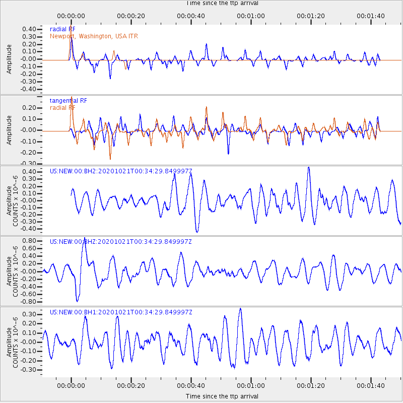
NEW Newport, Washington, USA - Earthquake Result Viewer
*The percent match for this event was below the threshold and hence no stack was calculated.
| Earthquake location: |
Tonga Islands Region |
| Earthquake latitude/longitude: |
-19.3/-172.4 |
| Earthquake time(UTC): |
2020/10/21 (295) 00:22:33 GMT |
| Earthquake Depth: |
10 km |
| Earthquake Magnitude: |
5.9 mww |
| Earthquake Catalog/Contributor: |
NEIC PDE/us |
|
| Network: |
US United States National Seismic Network |
| Station: |
NEW Newport, Washington, USA |
| Lat/Lon: |
48.26 N/117.12 W |
| Elevation: |
760 m |
|
| Distance: |
83.4 deg |
| Az: |
33.559 deg |
| Baz: |
231.379 deg |
| Ray Param: |
$rayparam |
*The percent match for this event was below the threshold and hence was not used in the summary stack. |
|
| Radial Match: |
64.76879 % |
| Radial Bump: |
313 |
| Transverse Match: |
40.876842 % |
| Transverse Bump: |
277 |
| SOD ConfigId: |
22732711 |
| Insert Time: |
2020-11-04 00:50:14.614 +0000 |
| GWidth: |
2.5 |
| Max Bumps: |
400 |
| Tol: |
0.001 |
|
Signal To Noise
| Channel | StoN | STA | LTA |
| US:NEW:00:BHZ:20201021T00:34:29.849997Z | 5.9597416 | 4.9665647E-7 | 8.333524E-8 |
| US:NEW:00:BH1:20201021T00:34:29.849997Z | 1.6001148 | 1.3926447E-7 | 8.7034046E-8 |
| US:NEW:00:BH2:20201021T00:34:29.849997Z | 2.124213 | 1.8044193E-7 | 8.4945306E-8 |
| Arrivals |
| Ps | |
| PpPs | |
| PsPs/PpSs | |


