You are here: Home > Network List > US - United States National Seismic Network Stations List
> Station HAWA Hanford, Washington, USA > Earthquake Result Viewer
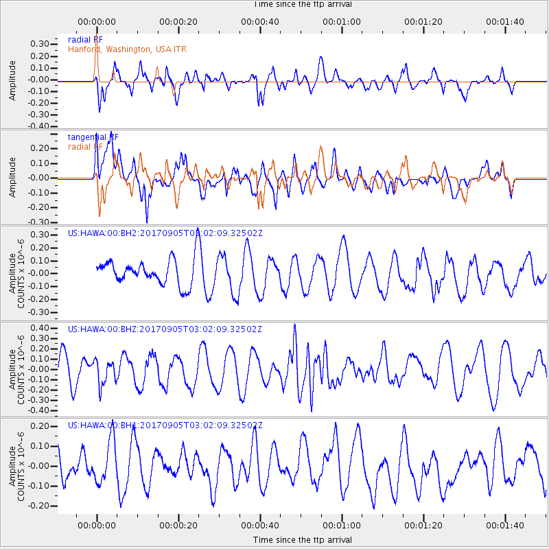
HAWA Hanford, Washington, USA - Earthquake Result Viewer
*The percent match for this event was below the threshold and hence no stack was calculated.
| Earthquake location: |
Vanuatu Islands |
| Earthquake latitude/longitude: |
-16.2/168.0 |
| Earthquake time(UTC): |
2017/09/05 (248) 02:50:00 GMT |
| Earthquake Depth: |
173 km |
| Earthquake Magnitude: |
5.5 Mww |
| Earthquake Catalog/Contributor: |
NEIC PDE/us |
|
| Network: |
US United States National Seismic Network |
| Station: |
HAWA Hanford, Washington, USA |
| Lat/Lon: |
46.39 N/119.53 W |
| Elevation: |
364 m |
|
| Distance: |
90.0 deg |
| Az: |
41.3 deg |
| Baz: |
246.35 deg |
| Ray Param: |
$rayparam |
*The percent match for this event was below the threshold and hence was not used in the summary stack. |
|
| Radial Match: |
56.805622 % |
| Radial Bump: |
400 |
| Transverse Match: |
59.71483 % |
| Transverse Bump: |
400 |
| SOD ConfigId: |
2307692 |
| Insert Time: |
2017-09-19 02:54:53.917 +0000 |
| GWidth: |
2.5 |
| Max Bumps: |
400 |
| Tol: |
0.001 |
|
Signal To Noise
| Channel | StoN | STA | LTA |
| US:HAWA:00:BHZ:20170905T03:02:09.32502Z | 0.98936707 | 1.220619E-7 | 1.2337372E-7 |
| US:HAWA:00:BH1:20170905T03:02:09.32502Z | 0.8808467 | 1.22561E-7 | 1.3914E-7 |
| US:HAWA:00:BH2:20170905T03:02:09.32502Z | 1.5095359 | 1.4838994E-7 | 9.83017E-8 |
| Arrivals |
| Ps | |
| PpPs | |
| PsPs/PpSs | |


