You are here: Home > Network List > CI - Caltech Regional Seismic Network Stations List
> Station MPM Manuel Prospect Mine, California, USA > Earthquake Result Viewer
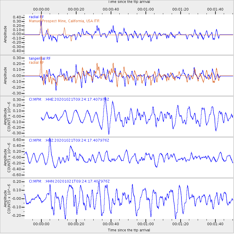
MPM Manuel Prospect Mine, California, USA - Earthquake Result Viewer
*The percent match for this event was below the threshold and hence no stack was calculated.
| Earthquake location: |
Near Coast Of Northern Chile |
| Earthquake latitude/longitude: |
-25.5/-71.0 |
| Earthquake time(UTC): |
2020/10/21 (295) 09:13:05 GMT |
| Earthquake Depth: |
9.4 km |
| Earthquake Magnitude: |
5.7 Mww |
| Earthquake Catalog/Contributor: |
NEIC PDE/us |
|
| Network: |
CI Caltech Regional Seismic Network |
| Station: |
MPM Manuel Prospect Mine, California, USA |
| Lat/Lon: |
36.06 N/117.49 W |
| Elevation: |
185 m |
|
| Distance: |
75.3 deg |
| Az: |
322.595 deg |
| Baz: |
137.361 deg |
| Ray Param: |
$rayparam |
*The percent match for this event was below the threshold and hence was not used in the summary stack. |
|
| Radial Match: |
58.834023 % |
| Radial Bump: |
400 |
| Transverse Match: |
56.550198 % |
| Transverse Bump: |
400 |
| SOD ConfigId: |
22732711 |
| Insert Time: |
2020-11-04 09:17:04.920 +0000 |
| GWidth: |
2.5 |
| Max Bumps: |
400 |
| Tol: |
0.001 |
|
Signal To Noise
| Channel | StoN | STA | LTA |
| CI:MPM: :HHZ:20201021T09:24:17.407976Z | 2.2128925 | 2.0601274E-7 | 9.309659E-8 |
| CI:MPM: :HHN:20201021T09:24:17.407976Z | 0.68369585 | 4.7799187E-8 | 6.991294E-8 |
| CI:MPM: :HHE:20201021T09:24:17.407976Z | 1.6460134 | 1.0636807E-7 | 6.462163E-8 |
| Arrivals |
| Ps | |
| PpPs | |
| PsPs/PpSs | |


