You are here: Home > Network List > GS - US Geological Survey Networks Stations List
> Station OK031 S. Brethren Rd., Cushing, OK, USA > Earthquake Result Viewer
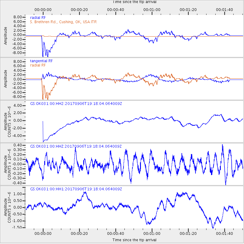
OK031 S. Brethren Rd., Cushing, OK, USA - Earthquake Result Viewer
*The percent match for this event was below the threshold and hence no stack was calculated.
| Earthquake location: |
Tonga Islands |
| Earthquake latitude/longitude: |
-15.4/-173.6 |
| Earthquake time(UTC): |
2017/09/06 (249) 19:05:48 GMT |
| Earthquake Depth: |
56 km |
| Earthquake Magnitude: |
5.1 mb |
| Earthquake Catalog/Contributor: |
NEIC PDE/us |
|
| Network: |
GS US Geological Survey Networks |
| Station: |
OK031 S. Brethren Rd., Cushing, OK, USA |
| Lat/Lon: |
35.95 N/96.84 W |
| Elevation: |
290 m |
|
| Distance: |
88.6 deg |
| Az: |
52.204 deg |
| Baz: |
249.949 deg |
| Ray Param: |
$rayparam |
*The percent match for this event was below the threshold and hence was not used in the summary stack. |
|
| Radial Match: |
56.700195 % |
| Radial Bump: |
400 |
| Transverse Match: |
67.08238 % |
| Transverse Bump: |
400 |
| SOD ConfigId: |
2307692 |
| Insert Time: |
2017-09-20 19:23:50.397 +0000 |
| GWidth: |
2.5 |
| Max Bumps: |
400 |
| Tol: |
0.001 |
|
Signal To Noise
| Channel | StoN | STA | LTA |
| GS:OK031:00:HHZ:20170906T19:18:04.064009Z | 1.1918052 | 1.5794022E-7 | 1.3252183E-7 |
| GS:OK031:00:HH1:20170906T19:18:04.064009Z | 1.2697058 | 1.539383E-6 | 1.2123935E-6 |
| GS:OK031:00:HH2:20170906T19:18:04.064009Z | 1.1876863 | 2.2345432E-6 | 1.8814255E-6 |
| Arrivals |
| Ps | |
| PpPs | |
| PsPs/PpSs | |


