You are here: Home > Network List > GM - US Geological Survey Networks Stations List
> Station IWM01 Jericho 2M Well Monitoring Station > Earthquake Result Viewer
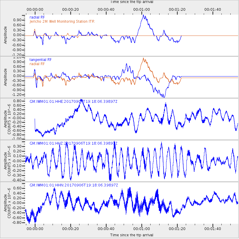
IWM01 Jericho 2M Well Monitoring Station - Earthquake Result Viewer
*The percent match for this event was below the threshold and hence no stack was calculated.
| Earthquake location: |
Tonga Islands |
| Earthquake latitude/longitude: |
-15.4/-173.6 |
| Earthquake time(UTC): |
2017/09/06 (249) 19:05:48 GMT |
| Earthquake Depth: |
56 km |
| Earthquake Magnitude: |
5.1 mb |
| Earthquake Catalog/Contributor: |
NEIC PDE/us |
|
| Network: |
GM US Geological Survey Networks |
| Station: |
IWM01 Jericho 2M Well Monitoring Station |
| Lat/Lon: |
36.73 N/96.53 W |
| Elevation: |
328 m |
|
| Distance: |
89.1 deg |
| Az: |
51.562 deg |
| Baz: |
250.117 deg |
| Ray Param: |
$rayparam |
*The percent match for this event was below the threshold and hence was not used in the summary stack. |
|
| Radial Match: |
25.925838 % |
| Radial Bump: |
400 |
| Transverse Match: |
15.945304 % |
| Transverse Bump: |
400 |
| SOD ConfigId: |
2307692 |
| Insert Time: |
2017-09-20 19:26:41.997 +0000 |
| GWidth: |
2.5 |
| Max Bumps: |
400 |
| Tol: |
0.001 |
|
Signal To Noise
| Channel | StoN | STA | LTA |
| GM:IWM01:01:HHZ:20170906T19:18:06.39897Z | 0.9391472 | 6.839589E-8 | 7.282767E-8 |
| GM:IWM01:01:HHN:20170906T19:18:06.39897Z | 1.2463787 | 6.986712E-7 | 5.60561E-7 |
| GM:IWM01:01:HHE:20170906T19:18:06.39897Z | 1.6943368 | 6.2924533E-7 | 3.7138153E-7 |
| Arrivals |
| Ps | |
| PpPs | |
| PsPs/PpSs | |


