You are here: Home > Network List > US - United States National Seismic Network Stations List
> Station LAO LASA Array, Montana, USA > Earthquake Result Viewer
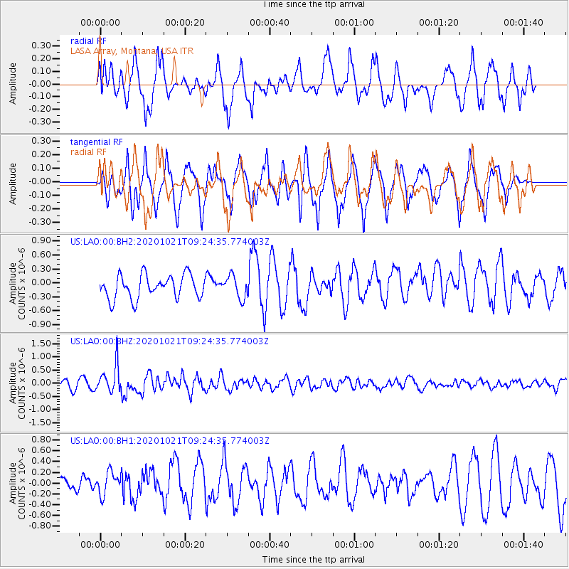
LAO LASA Array, Montana, USA - Earthquake Result Viewer
*The percent match for this event was below the threshold and hence no stack was calculated.
| Earthquake location: |
Near Coast Of Northern Chile |
| Earthquake latitude/longitude: |
-25.5/-71.0 |
| Earthquake time(UTC): |
2020/10/21 (295) 09:13:05 GMT |
| Earthquake Depth: |
9.4 km |
| Earthquake Magnitude: |
5.7 Mww |
| Earthquake Catalog/Contributor: |
NEIC PDE/us |
|
| Network: |
US United States National Seismic Network |
| Station: |
LAO LASA Array, Montana, USA |
| Lat/Lon: |
46.69 N/106.22 W |
| Elevation: |
902 m |
|
| Distance: |
78.6 deg |
| Az: |
336.107 deg |
| Baz: |
147.883 deg |
| Ray Param: |
$rayparam |
*The percent match for this event was below the threshold and hence was not used in the summary stack. |
|
| Radial Match: |
41.263443 % |
| Radial Bump: |
381 |
| Transverse Match: |
58.876602 % |
| Transverse Bump: |
385 |
| SOD ConfigId: |
22732711 |
| Insert Time: |
2020-11-04 09:35:24.314 +0000 |
| GWidth: |
2.5 |
| Max Bumps: |
400 |
| Tol: |
0.001 |
|
Signal To Noise
| Channel | StoN | STA | LTA |
| US:LAO:00:BHZ:20201021T09:24:35.774003Z | 3.6312962 | 5.280979E-7 | 1.4542958E-7 |
| US:LAO:00:BH1:20201021T09:24:35.774003Z | 1.0302353 | 2.1939434E-7 | 2.1295557E-7 |
| US:LAO:00:BH2:20201021T09:24:35.774003Z | 0.98097056 | 2.4664354E-7 | 2.5142808E-7 |
| Arrivals |
| Ps | |
| PpPs | |
| PsPs/PpSs | |


