You are here: Home > Network List > US - United States National Seismic Network Stations List
> Station WMOK Wichita Mountains, Oklahoma, USA > Earthquake Result Viewer
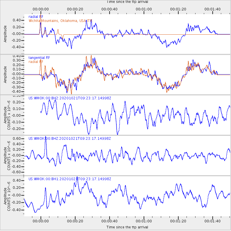
WMOK Wichita Mountains, Oklahoma, USA - Earthquake Result Viewer
*The percent match for this event was below the threshold and hence no stack was calculated.
| Earthquake location: |
Near Coast Of Northern Chile |
| Earthquake latitude/longitude: |
-25.5/-71.0 |
| Earthquake time(UTC): |
2020/10/21 (295) 09:13:05 GMT |
| Earthquake Depth: |
9.4 km |
| Earthquake Magnitude: |
5.7 Mww |
| Earthquake Catalog/Contributor: |
NEIC PDE/us |
|
| Network: |
US United States National Seismic Network |
| Station: |
WMOK Wichita Mountains, Oklahoma, USA |
| Lat/Lon: |
34.74 N/98.78 W |
| Elevation: |
486 m |
|
| Distance: |
65.5 deg |
| Az: |
335.039 deg |
| Baz: |
152.418 deg |
| Ray Param: |
$rayparam |
*The percent match for this event was below the threshold and hence was not used in the summary stack. |
|
| Radial Match: |
50.547417 % |
| Radial Bump: |
400 |
| Transverse Match: |
47.77559 % |
| Transverse Bump: |
400 |
| SOD ConfigId: |
22732711 |
| Insert Time: |
2020-11-04 09:35:51.392 +0000 |
| GWidth: |
2.5 |
| Max Bumps: |
400 |
| Tol: |
0.001 |
|
Signal To Noise
| Channel | StoN | STA | LTA |
| US:WMOK:00:BHZ:20201021T09:23:17.14998Z | 2.5294921 | 2.3480692E-7 | 9.282769E-8 |
| US:WMOK:00:BH1:20201021T09:23:17.14998Z | 1.8529748 | 4.3254806E-7 | 2.334344E-7 |
| US:WMOK:00:BH2:20201021T09:23:17.14998Z | 1.5226836 | 1.5339384E-7 | 1.0073914E-7 |
| Arrivals |
| Ps | |
| PpPs | |
| PsPs/PpSs | |


