You are here: Home > Network List > GS - US Geological Survey Networks Stations List
> Station MT03 Stemple Pass Rd, Helena Natl Forest, Montana, USA > Earthquake Result Viewer
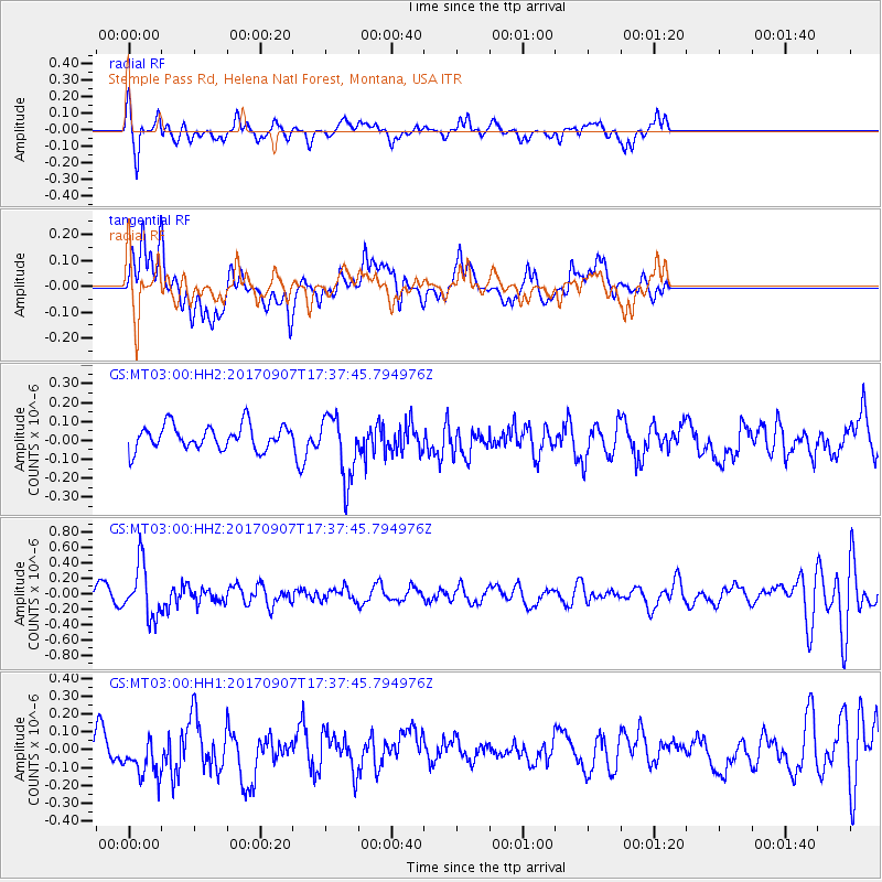
MT03 Stemple Pass Rd, Helena Natl Forest, Montana, USA - Earthquake Result Viewer
*The percent match for this event was below the threshold and hence no stack was calculated.
| Earthquake location: |
Bonin Islands, Japan Region |
| Earthquake latitude/longitude: |
27.8/139.8 |
| Earthquake time(UTC): |
2017/09/07 (250) 17:26:49 GMT |
| Earthquake Depth: |
448 km |
| Earthquake Magnitude: |
6.1 Mww |
| Earthquake Catalog/Contributor: |
NEIC PDE/us |
|
| Network: |
GS US Geological Survey Networks |
| Station: |
MT03 Stemple Pass Rd, Helena Natl Forest, Montana, USA |
| Lat/Lon: |
46.91 N/112.50 W |
| Elevation: |
2025 m |
|
| Distance: |
81.2 deg |
| Az: |
41.367 deg |
| Baz: |
301.321 deg |
| Ray Param: |
$rayparam |
*The percent match for this event was below the threshold and hence was not used in the summary stack. |
|
| Radial Match: |
48.48668 % |
| Radial Bump: |
334 |
| Transverse Match: |
50.961113 % |
| Transverse Bump: |
400 |
| SOD ConfigId: |
2307692 |
| Insert Time: |
2017-09-21 17:32:33.603 +0000 |
| GWidth: |
2.5 |
| Max Bumps: |
400 |
| Tol: |
0.001 |
|
Signal To Noise
| Channel | StoN | STA | LTA |
| GS:MT03:00:HHZ:20170907T17:37:45.794976Z | 4.6982417 | 3.3672202E-7 | 7.1669795E-8 |
| GS:MT03:00:HH1:20170907T17:37:45.794976Z | 1.6262244 | 1.2796754E-7 | 7.8689965E-8 |
| GS:MT03:00:HH2:20170907T17:37:45.794976Z | 2.6610937 | 1.7114861E-7 | 6.431514E-8 |
| Arrivals |
| Ps | |
| PpPs | |
| PsPs/PpSs | |


