You are here: Home > Network List > CI - Caltech Regional Seismic Network Stations List
> Station MPM Manuel Prospect Mine, California, USA > Earthquake Result Viewer
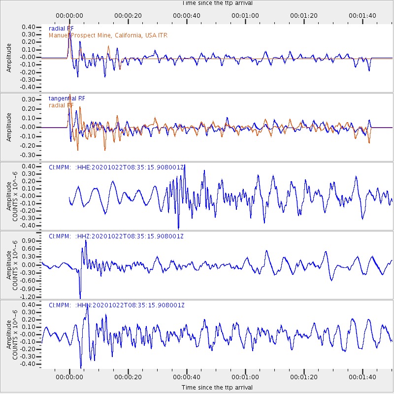
MPM Manuel Prospect Mine, California, USA - Earthquake Result Viewer
*The percent match for this event was below the threshold and hence no stack was calculated.
| Earthquake location: |
Fiji Islands Region |
| Earthquake latitude/longitude: |
-20.9/-176.6 |
| Earthquake time(UTC): |
2020/10/22 (296) 08:24:06 GMT |
| Earthquake Depth: |
236 km |
| Earthquake Magnitude: |
5.7 Mww |
| Earthquake Catalog/Contributor: |
NEIC PDE/us |
|
| Network: |
CI Caltech Regional Seismic Network |
| Station: |
MPM Manuel Prospect Mine, California, USA |
| Lat/Lon: |
36.06 N/117.49 W |
| Elevation: |
185 m |
|
| Distance: |
79.5 deg |
| Az: |
44.976 deg |
| Baz: |
234.645 deg |
| Ray Param: |
$rayparam |
*The percent match for this event was below the threshold and hence was not used in the summary stack. |
|
| Radial Match: |
67.74471 % |
| Radial Bump: |
400 |
| Transverse Match: |
35.30943 % |
| Transverse Bump: |
400 |
| SOD ConfigId: |
22732711 |
| Insert Time: |
2020-11-05 08:35:12.488 +0000 |
| GWidth: |
2.5 |
| Max Bumps: |
400 |
| Tol: |
0.001 |
|
Signal To Noise
| Channel | StoN | STA | LTA |
| CI:MPM: :HHZ:20201022T08:35:15.908001Z | 2.8364968 | 3.80087E-7 | 1.3399874E-7 |
| CI:MPM: :HHN:20201022T08:35:15.908001Z | 2.2069204 | 1.5859307E-7 | 7.18617E-8 |
| CI:MPM: :HHE:20201022T08:35:15.908001Z | 1.289177 | 1.2299107E-7 | 9.540278E-8 |
| Arrivals |
| Ps | |
| PpPs | |
| PsPs/PpSs | |


