You are here: Home > Network List > CN - Canadian National Seismograph Network Stations List
> Station INK INUVIK, NT > Earthquake Result Viewer
INK INUVIK, NT - Earthquake Result Viewer
*The percent match for this event was below the threshold and hence no stack was calculated.
| Earthquake location: |
Fiji Islands Region |
| Earthquake latitude/longitude: |
-20.9/-176.6 |
| Earthquake time(UTC): |
2020/10/22 (296) 08:24:06 GMT |
| Earthquake Depth: |
236 km |
| Earthquake Magnitude: |
5.7 Mww |
| Earthquake Catalog/Contributor: |
NEIC PDE/us |
|
| Network: |
CN Canadian National Seismograph Network |
| Station: |
INK INUVIK, NT |
| Lat/Lon: |
68.31 N/133.53 W |
| Elevation: |
44 m |
|
| Distance: |
94.3 deg |
| Az: |
14.74 deg |
| Baz: |
219.781 deg |
| Ray Param: |
$rayparam |
*The percent match for this event was below the threshold and hence was not used in the summary stack. |
|
| Radial Match: |
52.566338 % |
| Radial Bump: |
400 |
| Transverse Match: |
57.24711 % |
| Transverse Bump: |
400 |
| SOD ConfigId: |
22732711 |
| Insert Time: |
2020-11-05 08:36:39.959 +0000 |
| GWidth: |
2.5 |
| Max Bumps: |
400 |
| Tol: |
0.001 |
|
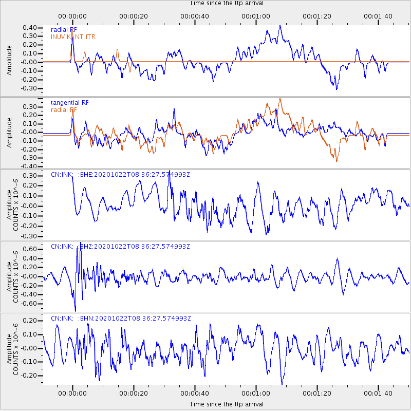
Signal To Noise
| Channel | StoN | STA | LTA |
| CN:INK: :BHZ:20201022T08:36:27.574993Z | 5.2600865 | 3.690695E-7 | 7.0164155E-8 |
| CN:INK: :BHN:20201022T08:36:27.574993Z | 0.8340458 | 8.218805E-8 | 9.8541406E-8 |
| CN:INK: :BHE:20201022T08:36:27.574993Z | 1.3707843 | 1.3129483E-7 | 9.578081E-8 |
| Arrivals |
| Ps | |
| PpPs | |
| PsPs/PpSs | |


