You are here: Home > Network List > US - United States National Seismic Network Stations List
> Station DGMT Dagmar, Montana, USA > Earthquake Result Viewer
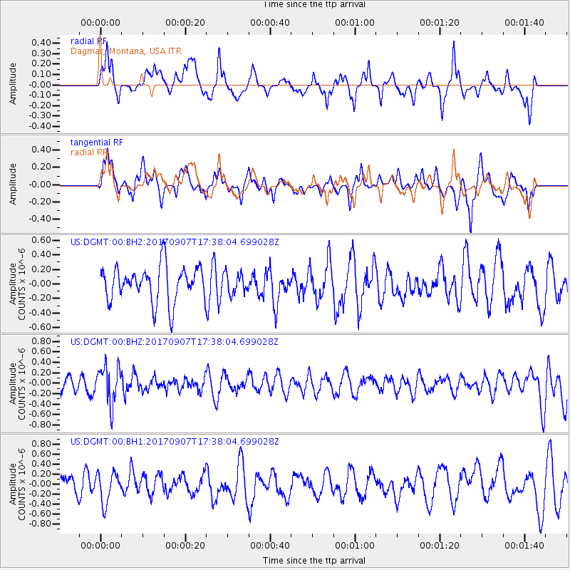
DGMT Dagmar, Montana, USA - Earthquake Result Viewer
*The percent match for this event was below the threshold and hence no stack was calculated.
| Earthquake location: |
Bonin Islands, Japan Region |
| Earthquake latitude/longitude: |
27.8/139.8 |
| Earthquake time(UTC): |
2017/09/07 (250) 17:26:49 GMT |
| Earthquake Depth: |
448 km |
| Earthquake Magnitude: |
6.1 Mww |
| Earthquake Catalog/Contributor: |
NEIC PDE/us |
|
| Network: |
US United States National Seismic Network |
| Station: |
DGMT Dagmar, Montana, USA |
| Lat/Lon: |
48.47 N/104.20 W |
| Elevation: |
0.0 m |
|
| Distance: |
85.0 deg |
| Az: |
36.904 deg |
| Baz: |
306.91 deg |
| Ray Param: |
$rayparam |
*The percent match for this event was below the threshold and hence was not used in the summary stack. |
|
| Radial Match: |
55.129517 % |
| Radial Bump: |
400 |
| Transverse Match: |
46.316414 % |
| Transverse Bump: |
400 |
| SOD ConfigId: |
2307692 |
| Insert Time: |
2017-09-21 17:34:21.713 +0000 |
| GWidth: |
2.5 |
| Max Bumps: |
400 |
| Tol: |
0.001 |
|
Signal To Noise
| Channel | StoN | STA | LTA |
| US:DGMT:00:BHZ:20170907T17:38:04.699028Z | 2.5089822 | 3.6657738E-7 | 1.4610602E-7 |
| US:DGMT:00:BH1:20170907T17:38:04.699028Z | 1.2945297 | 3.065496E-7 | 2.3680384E-7 |
| US:DGMT:00:BH2:20170907T17:38:04.699028Z | 0.5556 | 1.3618195E-7 | 2.451079E-7 |
| Arrivals |
| Ps | |
| PpPs | |
| PsPs/PpSs | |


