You are here: Home > Network List > US - United States National Seismic Network Stations List
> Station EGMT Eagleton, Montana, USA > Earthquake Result Viewer
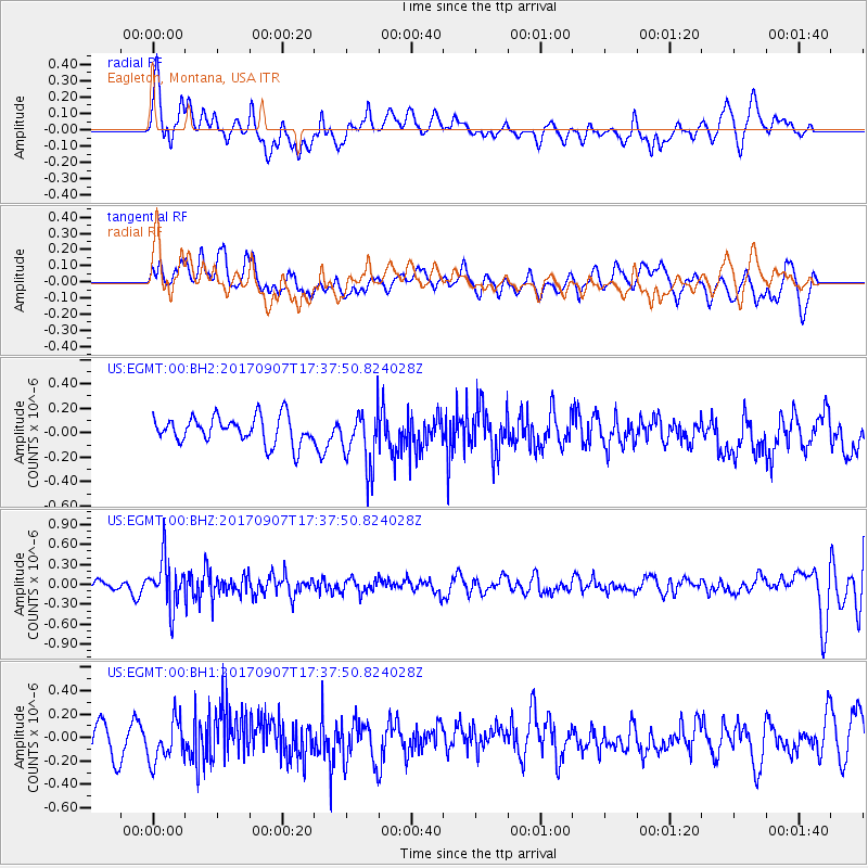
EGMT Eagleton, Montana, USA - Earthquake Result Viewer
*The percent match for this event was below the threshold and hence no stack was calculated.
| Earthquake location: |
Bonin Islands, Japan Region |
| Earthquake latitude/longitude: |
27.8/139.8 |
| Earthquake time(UTC): |
2017/09/07 (250) 17:26:49 GMT |
| Earthquake Depth: |
448 km |
| Earthquake Magnitude: |
6.1 Mww |
| Earthquake Catalog/Contributor: |
NEIC PDE/us |
|
| Network: |
US United States National Seismic Network |
| Station: |
EGMT Eagleton, Montana, USA |
| Lat/Lon: |
48.02 N/109.75 W |
| Elevation: |
1055 m |
|
| Distance: |
82.2 deg |
| Az: |
39.415 deg |
| Baz: |
303.054 deg |
| Ray Param: |
$rayparam |
*The percent match for this event was below the threshold and hence was not used in the summary stack. |
|
| Radial Match: |
54.202652 % |
| Radial Bump: |
400 |
| Transverse Match: |
47.884624 % |
| Transverse Bump: |
400 |
| SOD ConfigId: |
2307692 |
| Insert Time: |
2017-09-21 17:34:25.658 +0000 |
| GWidth: |
2.5 |
| Max Bumps: |
400 |
| Tol: |
0.001 |
|
Signal To Noise
| Channel | StoN | STA | LTA |
| US:EGMT:00:BHZ:20170907T17:37:50.824028Z | 4.4246407 | 3.622581E-7 | 8.187289E-8 |
| US:EGMT:00:BH1:20170907T17:37:50.824028Z | 1.2875323 | 1.8804926E-7 | 1.46054E-7 |
| US:EGMT:00:BH2:20170907T17:37:50.824028Z | 2.1689978 | 2.378029E-7 | 1.0963723E-7 |
| Arrivals |
| Ps | |
| PpPs | |
| PsPs/PpSs | |


