You are here: Home > Network List > TA - USArray Transportable Network (new EarthScope stations) Stations List
> Station D23K Nanushuk River, AK USA > Earthquake Result Viewer
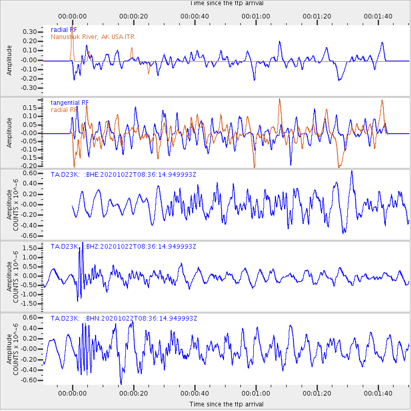
D23K Nanushuk River, AK USA - Earthquake Result Viewer
*The percent match for this event was below the threshold and hence no stack was calculated.
| Earthquake location: |
Fiji Islands Region |
| Earthquake latitude/longitude: |
-20.9/-176.6 |
| Earthquake time(UTC): |
2020/10/22 (296) 08:24:06 GMT |
| Earthquake Depth: |
236 km |
| Earthquake Magnitude: |
5.7 Mww |
| Earthquake Catalog/Contributor: |
NEIC PDE/us |
|
| Network: |
TA USArray Transportable Network (new EarthScope stations) |
| Station: |
D23K Nanushuk River, AK USA |
| Lat/Lon: |
68.97 N/150.68 W |
| Elevation: |
406 m |
|
| Distance: |
91.5 deg |
| Az: |
9.069 deg |
| Baz: |
204.093 deg |
| Ray Param: |
$rayparam |
*The percent match for this event was below the threshold and hence was not used in the summary stack. |
|
| Radial Match: |
67.12793 % |
| Radial Bump: |
400 |
| Transverse Match: |
52.801334 % |
| Transverse Bump: |
400 |
| SOD ConfigId: |
22732711 |
| Insert Time: |
2020-11-05 08:44:15.763 +0000 |
| GWidth: |
2.5 |
| Max Bumps: |
400 |
| Tol: |
0.001 |
|
Signal To Noise
| Channel | StoN | STA | LTA |
| TA:D23K: :BHZ:20201022T08:36:14.949993Z | 2.4113567 | 7.0722854E-7 | 2.9329073E-7 |
| TA:D23K: :BHN:20201022T08:36:14.949993Z | 0.99550194 | 2.554902E-7 | 2.566446E-7 |
| TA:D23K: :BHE:20201022T08:36:14.949993Z | 1.1080961 | 1.5641506E-7 | 1.4115656E-7 |
| Arrivals |
| Ps | |
| PpPs | |
| PsPs/PpSs | |


