You are here: Home > Network List > TA - USArray Transportable Network (new EarthScope stations) Stations List
> Station E20K Nigu River, AK, USA > Earthquake Result Viewer
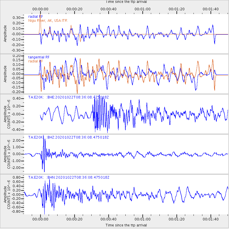
E20K Nigu River, AK, USA - Earthquake Result Viewer
*The percent match for this event was below the threshold and hence no stack was calculated.
| Earthquake location: |
Fiji Islands Region |
| Earthquake latitude/longitude: |
-20.9/-176.6 |
| Earthquake time(UTC): |
2020/10/22 (296) 08:24:06 GMT |
| Earthquake Depth: |
236 km |
| Earthquake Magnitude: |
5.7 Mww |
| Earthquake Catalog/Contributor: |
NEIC PDE/us |
|
| Network: |
TA USArray Transportable Network (new EarthScope stations) |
| Station: |
E20K Nigu River, AK, USA |
| Lat/Lon: |
68.26 N/156.19 W |
| Elevation: |
866 m |
|
| Distance: |
90.1 deg |
| Az: |
7.451 deg |
| Baz: |
198.992 deg |
| Ray Param: |
$rayparam |
*The percent match for this event was below the threshold and hence was not used in the summary stack. |
|
| Radial Match: |
65.07339 % |
| Radial Bump: |
400 |
| Transverse Match: |
57.298294 % |
| Transverse Bump: |
400 |
| SOD ConfigId: |
22732711 |
| Insert Time: |
2020-11-05 08:44:21.547 +0000 |
| GWidth: |
2.5 |
| Max Bumps: |
400 |
| Tol: |
0.001 |
|
Signal To Noise
| Channel | StoN | STA | LTA |
| TA:E20K: :BHZ:20201022T08:36:08.475018Z | 7.9053726 | 1.0161673E-6 | 1.2854136E-7 |
| TA:E20K: :BHN:20201022T08:36:08.475018Z | 2.9443817 | 3.1549976E-7 | 1.0715315E-7 |
| TA:E20K: :BHE:20201022T08:36:08.475018Z | 1.9012191 | 2.2411508E-7 | 1.17879665E-7 |
| Arrivals |
| Ps | |
| PpPs | |
| PsPs/PpSs | |


