You are here: Home > Network List > TA - USArray Transportable Network (new EarthScope stations) Stations List
> Station I30M Mount Dempster, Yukon, CAN > Earthquake Result Viewer
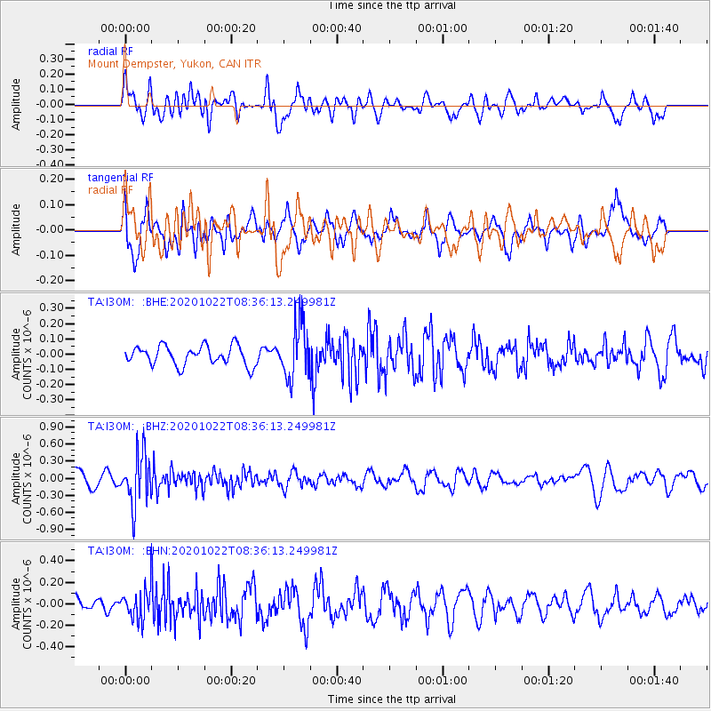
I30M Mount Dempster, Yukon, CAN - Earthquake Result Viewer
*The percent match for this event was below the threshold and hence no stack was calculated.
| Earthquake location: |
Fiji Islands Region |
| Earthquake latitude/longitude: |
-20.9/-176.6 |
| Earthquake time(UTC): |
2020/10/22 (296) 08:24:06 GMT |
| Earthquake Depth: |
236 km |
| Earthquake Magnitude: |
5.7 Mww |
| Earthquake Catalog/Contributor: |
NEIC PDE/us |
|
| Network: |
TA USArray Transportable Network (new EarthScope stations) |
| Station: |
I30M Mount Dempster, Yukon, CAN |
| Lat/Lon: |
65.22 N/136.38 W |
| Elevation: |
1399 m |
|
| Distance: |
91.2 deg |
| Az: |
15.781 deg |
| Baz: |
217.113 deg |
| Ray Param: |
$rayparam |
*The percent match for this event was below the threshold and hence was not used in the summary stack. |
|
| Radial Match: |
53.35512 % |
| Radial Bump: |
400 |
| Transverse Match: |
56.981693 % |
| Transverse Bump: |
400 |
| SOD ConfigId: |
22732711 |
| Insert Time: |
2020-11-05 08:45:07.374 +0000 |
| GWidth: |
2.5 |
| Max Bumps: |
400 |
| Tol: |
0.001 |
|
Signal To Noise
| Channel | StoN | STA | LTA |
| TA:I30M: :BHZ:20201022T08:36:13.249981Z | 3.6057663 | 4.5320323E-7 | 1.2568846E-7 |
| TA:I30M: :BHN:20201022T08:36:13.249981Z | 1.8679075 | 1.3874794E-7 | 7.4279875E-8 |
| TA:I30M: :BHE:20201022T08:36:13.249981Z | 2.9072535 | 1.8245304E-7 | 6.275787E-8 |
| Arrivals |
| Ps | |
| PpPs | |
| PsPs/PpSs | |


