You are here: Home > Network List > US - United States National Seismic Network Stations List
> Station EGMT Eagleton, Montana, USA > Earthquake Result Viewer
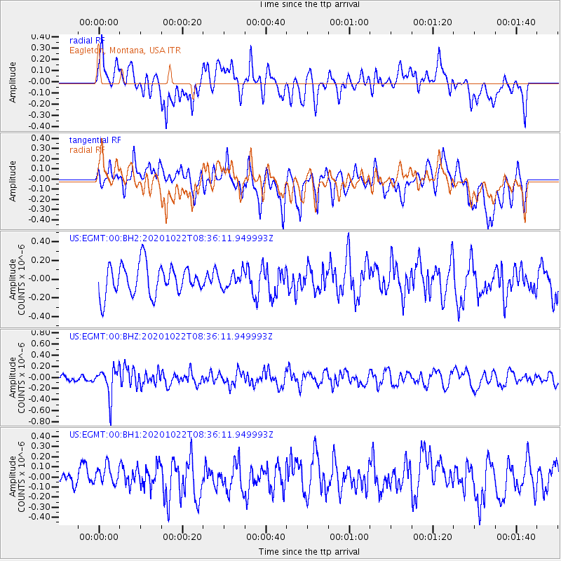
EGMT Eagleton, Montana, USA - Earthquake Result Viewer
*The percent match for this event was below the threshold and hence no stack was calculated.
| Earthquake location: |
Fiji Islands Region |
| Earthquake latitude/longitude: |
-20.9/-176.6 |
| Earthquake time(UTC): |
2020/10/22 (296) 08:24:06 GMT |
| Earthquake Depth: |
236 km |
| Earthquake Magnitude: |
5.7 Mww |
| Earthquake Catalog/Contributor: |
NEIC PDE/us |
|
| Network: |
US United States National Seismic Network |
| Station: |
EGMT Eagleton, Montana, USA |
| Lat/Lon: |
48.02 N/109.75 W |
| Elevation: |
1055 m |
|
| Distance: |
90.9 deg |
| Az: |
38.105 deg |
| Baz: |
239.262 deg |
| Ray Param: |
$rayparam |
*The percent match for this event was below the threshold and hence was not used in the summary stack. |
|
| Radial Match: |
59.35609 % |
| Radial Bump: |
400 |
| Transverse Match: |
61.992245 % |
| Transverse Bump: |
400 |
| SOD ConfigId: |
22732711 |
| Insert Time: |
2020-11-05 08:48:02.608 +0000 |
| GWidth: |
2.5 |
| Max Bumps: |
400 |
| Tol: |
0.001 |
|
Signal To Noise
| Channel | StoN | STA | LTA |
| US:EGMT:00:BHZ:20201022T08:36:11.949993Z | 3.291596 | 2.6509286E-7 | 8.0536275E-8 |
| US:EGMT:00:BH1:20201022T08:36:11.949993Z | 0.97514653 | 9.3649504E-8 | 9.6036345E-8 |
| US:EGMT:00:BH2:20201022T08:36:11.949993Z | 0.5237961 | 8.3630816E-8 | 1.5966292E-7 |
| Arrivals |
| Ps | |
| PpPs | |
| PsPs/PpSs | |


