MVL Millersville University, PA - Earthquake Result Viewer
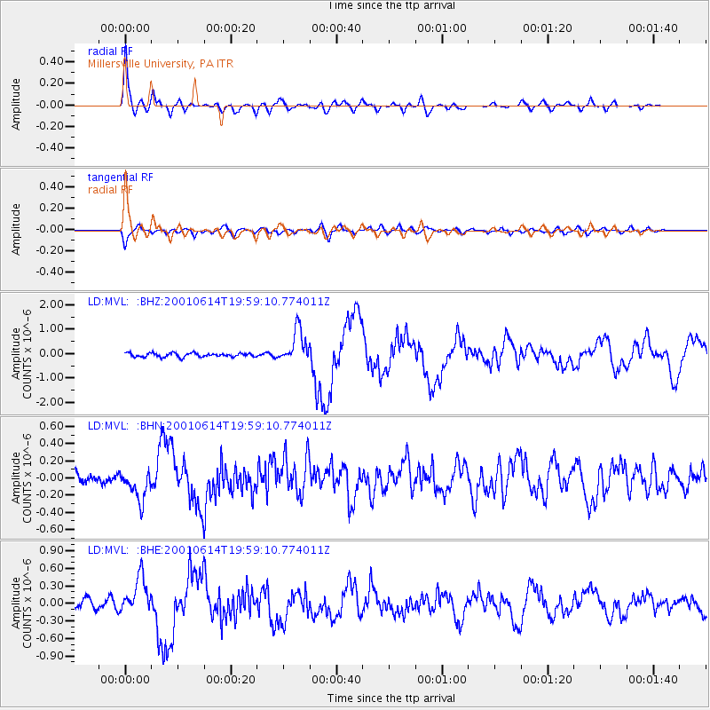
Earthquake location: Andreanof Islands, Aleutian Is.
Earthquake latitude/longitude: 51.2/-179.8
Earthquake time(UTC): 2001/06/14 (165) 19:48:47 GMT
Earthquake Depth: 18 km
Earthquake Magnitude: 6.0 MB, 6.3 MS, 6.5 MW, 6.1 ML
Earthquake Catalog/Contributor: WHDF/NEIC
Network: LD Lamont-Doherty Cooperative Seismographic Network
Station: MVL Millersville University, PA
Lat/Lon: 40.00 N/76.35 W
Elevation: 91 m
Distance: 67.4 deg
Az: 54.025 deg
Baz: 318.441 deg
Ray Param: 0.056978088
Estimated Moho Depth: 49.25 km
Estimated Crust Vp/Vs: 1.68
Assumed Crust Vp: 6.419 km/s
Estimated Crust Vs: 3.832 km/s
Estimated Crust Poisson's Ratio: 0.22
Radial Match: 91.64991 %
Radial Bump: 400
Transverse Match: 76.8417 %
Transverse Bump: 400
SOD ConfigId: 20082
Insert Time: 2010-03-09 02:57:15.224 +0000
GWidth: 2.5
Max Bumps: 400
Tol: 0.001

Signal To Noise

ChannelStoNSTALTA
LD:MVL: :BHN:20010614T19:59:10.774011Z1.99120551.774134E-78.909849E-8
LD:MVL: :BHE:20010614T19:59:10.774011Z3.45068933.2395036E-79.38799E-8
LD:MVL: :BHZ:20010614T19:59:10.774011Z8.86313156.86344E-77.743809E-8
Arrivals
Ps5.4 SECOND
PpPs20 SECOND
PsPs/PpSs25 SECOND