You are here: Home > Network List > LD - Lamont-Doherty Cooperative Seismographic Network Stations List
> Station MVL Millersville University, PA > Earthquake Result Viewer
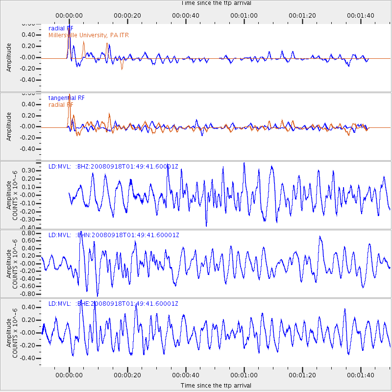
MVL Millersville University, PA - Earthquake Result Viewer
*The percent match for this event was below the threshold and hence no stack was calculated.
| Earthquake location: |
Central East Pacific Rise |
| Earthquake latitude/longitude: |
-4.6/-106.0 |
| Earthquake time(UTC): |
2008/09/18 (262) 01:41:02 GMT |
| Earthquake Depth: |
10 km |
| Earthquake Magnitude: |
5.5 MB, 5.7 MS, 6.0 MW, 6.0 MW |
| Earthquake Catalog/Contributor: |
WHDF/NEIC |
|
| Network: |
LD Lamont-Doherty Cooperative Seismographic Network |
| Station: |
MVL Millersville University, PA |
| Lat/Lon: |
40.00 N/76.35 W |
| Elevation: |
91 m |
|
| Distance: |
52.0 deg |
| Az: |
28.811 deg |
| Baz: |
218.712 deg |
| Ray Param: |
$rayparam |
*The percent match for this event was below the threshold and hence was not used in the summary stack. |
|
| Radial Match: |
67.867744 % |
| Radial Bump: |
400 |
| Transverse Match: |
53.378494 % |
| Transverse Bump: |
400 |
| SOD ConfigId: |
2560 |
| Insert Time: |
2010-03-09 02:58:10.361 +0000 |
| GWidth: |
2.5 |
| Max Bumps: |
400 |
| Tol: |
0.001 |
|
Signal To Noise
| Channel | StoN | STA | LTA |
| LD:MVL: :BHN:20080918T01:49:41.60001Z | 2.2274628 | 3.8264804E-7 | 1.7178651E-7 |
| LD:MVL: :BHE:20080918T01:49:41.60001Z | 1.6664683 | 2.4221882E-7 | 1.453486E-7 |
| LD:MVL: :BHZ:20080918T01:49:41.60001Z | 1.2048166 | 1.4434104E-7 | 1.1980335E-7 |
| Arrivals |
| Ps | |
| PpPs | |
| PsPs/PpSs | |


