You are here: Home > Network List > LD - Lamont-Doherty Cooperative Seismographic Network Stations List
> Station MVL Millersville University, PA > Earthquake Result Viewer
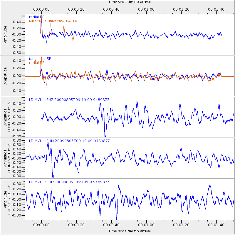
MVL Millersville University, PA - Earthquake Result Viewer
*The percent match for this event was below the threshold and hence no stack was calculated.
| Earthquake location: |
Gulf Of California |
| Earthquake latitude/longitude: |
29.6/-113.8 |
| Earthquake time(UTC): |
2009/08/05 (217) 09:13:12 GMT |
| Earthquake Depth: |
10 km |
| Earthquake Magnitude: |
5.5 MB, 5.6 MS, 5.7 MW |
| Earthquake Catalog/Contributor: |
WHDF/NEIC |
|
| Network: |
LD Lamont-Doherty Cooperative Seismographic Network |
| Station: |
MVL Millersville University, PA |
| Lat/Lon: |
40.00 N/76.35 W |
| Elevation: |
91 m |
|
| Distance: |
32.2 deg |
| Az: |
61.115 deg |
| Baz: |
263.001 deg |
| Ray Param: |
$rayparam |
*The percent match for this event was below the threshold and hence was not used in the summary stack. |
|
| Radial Match: |
70.207985 % |
| Radial Bump: |
351 |
| Transverse Match: |
50.356823 % |
| Transverse Bump: |
400 |
| SOD ConfigId: |
2622 |
| Insert Time: |
2010-03-09 02:58:16.784 +0000 |
| GWidth: |
2.5 |
| Max Bumps: |
400 |
| Tol: |
0.001 |
|
Signal To Noise
| Channel | StoN | STA | LTA |
| LD:MVL: :BHN:20090805T09:19:09.948987Z | 2.73528 | 3.1075183E-7 | 1.1360878E-7 |
| LD:MVL: :BHE:20090805T09:19:09.948987Z | 1.008895 | 1.00054116E-7 | 9.917197E-8 |
| LD:MVL: :BHZ:20090805T09:19:09.948987Z | 2.1677082 | 1.7076974E-7 | 7.877893E-8 |
| Arrivals |
| Ps | |
| PpPs | |
| PsPs/PpSs | |


