You are here: Home > Network List > US - United States National Seismic Network Stations List
> Station WMOK Wichita Mountains, Oklahoma, USA > Earthquake Result Viewer
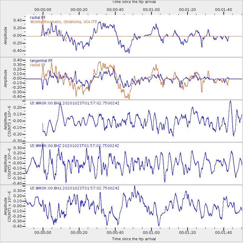
WMOK Wichita Mountains, Oklahoma, USA - Earthquake Result Viewer
*The percent match for this event was below the threshold and hence no stack was calculated.
| Earthquake location: |
West Chile Rise |
| Earthquake latitude/longitude: |
-36.4/-97.1 |
| Earthquake time(UTC): |
2020/10/23 (297) 01:46:17 GMT |
| Earthquake Depth: |
10 km |
| Earthquake Magnitude: |
6.0 mww |
| Earthquake Catalog/Contributor: |
NEIC PDE/us |
|
| Network: |
US United States National Seismic Network |
| Station: |
WMOK Wichita Mountains, Oklahoma, USA |
| Lat/Lon: |
34.74 N/98.78 W |
| Elevation: |
486 m |
|
| Distance: |
70.8 deg |
| Az: |
358.565 deg |
| Baz: |
178.594 deg |
| Ray Param: |
$rayparam |
*The percent match for this event was below the threshold and hence was not used in the summary stack. |
|
| Radial Match: |
31.027315 % |
| Radial Bump: |
400 |
| Transverse Match: |
46.134174 % |
| Transverse Bump: |
400 |
| SOD ConfigId: |
22732711 |
| Insert Time: |
2020-11-06 02:05:17.134 +0000 |
| GWidth: |
2.5 |
| Max Bumps: |
400 |
| Tol: |
0.001 |
|
Signal To Noise
| Channel | StoN | STA | LTA |
| US:WMOK:00:BHZ:20201023T01:57:02.750024Z | 1.704516 | 2.057242E-7 | 1.2069361E-7 |
| US:WMOK:00:BH1:20201023T01:57:02.750024Z | 0.51303726 | 1.242196E-7 | 2.4212585E-7 |
| US:WMOK:00:BH2:20201023T01:57:02.750024Z | 0.78354484 | 7.910502E-8 | 1.0095788E-7 |
| Arrivals |
| Ps | |
| PpPs | |
| PsPs/PpSs | |


