You are here: Home > Network List > AZ - ANZA Regional Network Stations List
> Station SMER AZ.SMER > Earthquake Result Viewer
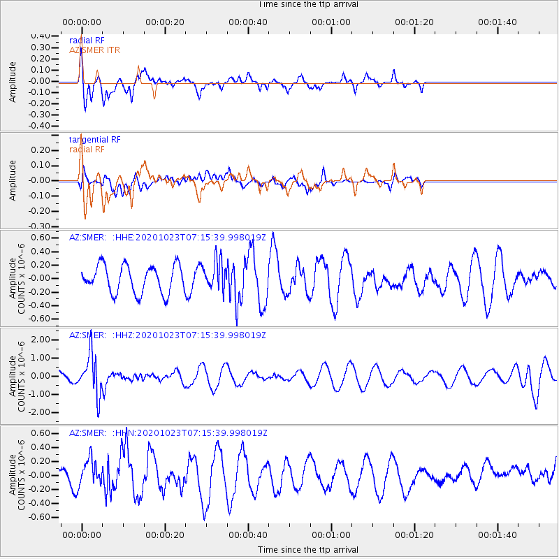
SMER AZ.SMER - Earthquake Result Viewer
*The percent match for this event was below the threshold and hence no stack was calculated.
| Earthquake location: |
South Of Fiji Islands |
| Earthquake latitude/longitude: |
-25.6/-180.0 |
| Earthquake time(UTC): |
2020/10/23 (297) 07:04:32 GMT |
| Earthquake Depth: |
464 km |
| Earthquake Magnitude: |
6.1 Mww |
| Earthquake Catalog/Contributor: |
NEIC PDE/us |
|
| Network: |
AZ ANZA Regional Network |
| Station: |
SMER AZ.SMER |
| Lat/Lon: |
33.46 N/117.17 W |
| Elevation: |
355 m |
|
| Distance: |
83.7 deg |
| Az: |
48.415 deg |
| Baz: |
233.882 deg |
| Ray Param: |
$rayparam |
*The percent match for this event was below the threshold and hence was not used in the summary stack. |
|
| Radial Match: |
60.683983 % |
| Radial Bump: |
400 |
| Transverse Match: |
45.870914 % |
| Transverse Bump: |
400 |
| SOD ConfigId: |
22732711 |
| Insert Time: |
2020-11-06 07:12:08.899 +0000 |
| GWidth: |
2.5 |
| Max Bumps: |
400 |
| Tol: |
0.001 |
|
Signal To Noise
| Channel | StoN | STA | LTA |
| AZ:SMER: :HHZ:20201023T07:15:39.998019Z | 3.8115711 | 1.1158946E-6 | 2.92765E-7 |
| AZ:SMER: :HHN:20201023T07:15:39.998019Z | 0.8358162 | 1.7856489E-7 | 2.1364133E-7 |
| AZ:SMER: :HHE:20201023T07:15:39.998019Z | 1.0581462 | 2.1461359E-7 | 2.0282035E-7 |
| Arrivals |
| Ps | |
| PpPs | |
| PsPs/PpSs | |


