You are here: Home > Network List > LD - Lamont-Doherty Cooperative Seismographic Network Stations List
> Station MVL Millersville University, PA > Earthquake Result Viewer
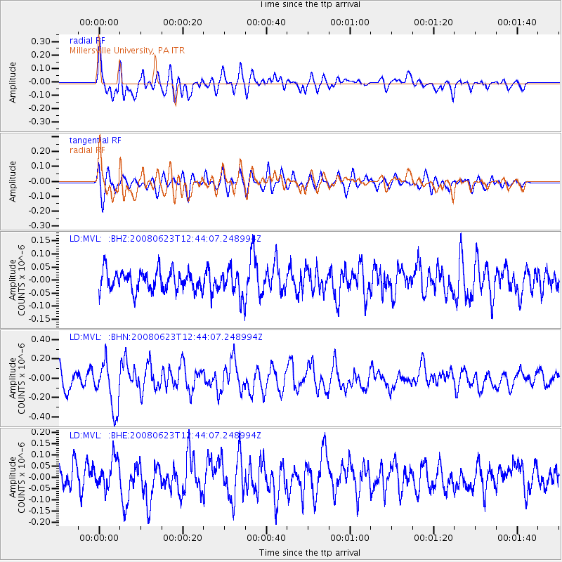
MVL Millersville University, PA - Earthquake Result Viewer
*The percent match for this event was below the threshold and hence no stack was calculated.
| Earthquake location: |
Kuril Islands |
| Earthquake latitude/longitude: |
46.5/153.3 |
| Earthquake time(UTC): |
2008/06/23 (175) 12:32:12 GMT |
| Earthquake Depth: |
10 km |
| Earthquake Magnitude: |
5.6 MB, 5.2 MS, 5.6 MW, 5.6 MW |
| Earthquake Catalog/Contributor: |
WHDF/NEIC |
|
| Network: |
LD Lamont-Doherty Cooperative Seismographic Network |
| Station: |
MVL Millersville University, PA |
| Lat/Lon: |
40.00 N/76.35 W |
| Elevation: |
91 m |
|
| Distance: |
83.2 deg |
| Az: |
36.109 deg |
| Baz: |
327.986 deg |
| Ray Param: |
$rayparam |
*The percent match for this event was below the threshold and hence was not used in the summary stack. |
|
| Radial Match: |
64.93147 % |
| Radial Bump: |
400 |
| Transverse Match: |
58.121838 % |
| Transverse Bump: |
400 |
| SOD ConfigId: |
2504 |
| Insert Time: |
2010-03-09 02:58:40.655 +0000 |
| GWidth: |
2.5 |
| Max Bumps: |
400 |
| Tol: |
0.001 |
|
Signal To Noise
| Channel | StoN | STA | LTA |
| LD:MVL: :BHN:20080623T12:44:07.248994Z | 3.0068567 | 2.4884878E-7 | 8.2760444E-8 |
| LD:MVL: :BHE:20080623T12:44:07.248994Z | 1.510219 | 6.5943105E-8 | 4.36646E-8 |
| LD:MVL: :BHZ:20080623T12:44:07.248994Z | 1.4620134 | 5.4081223E-8 | 3.6990922E-8 |
| Arrivals |
| Ps | |
| PpPs | |
| PsPs/PpSs | |


