You are here: Home > Network List > CI - Caltech Regional Seismic Network Stations List
> Station DAN Danby, California, USA > Earthquake Result Viewer
DAN Danby, California, USA - Earthquake Result Viewer
*The percent match for this event was below the threshold and hence no stack was calculated.
| Earthquake location: |
South Of Fiji Islands |
| Earthquake latitude/longitude: |
-25.6/-180.0 |
| Earthquake time(UTC): |
2020/10/23 (297) 07:04:32 GMT |
| Earthquake Depth: |
464 km |
| Earthquake Magnitude: |
6.1 Mww |
| Earthquake Catalog/Contributor: |
NEIC PDE/us |
|
| Network: |
CI Caltech Regional Seismic Network |
| Station: |
DAN Danby, California, USA |
| Lat/Lon: |
34.64 N/115.38 W |
| Elevation: |
398 m |
|
| Distance: |
85.6 deg |
| Az: |
48.324 deg |
| Baz: |
234.871 deg |
| Ray Param: |
$rayparam |
*The percent match for this event was below the threshold and hence was not used in the summary stack. |
|
| Radial Match: |
38.809303 % |
| Radial Bump: |
400 |
| Transverse Match: |
57.763294 % |
| Transverse Bump: |
400 |
| SOD ConfigId: |
22732711 |
| Insert Time: |
2020-11-06 07:14:46.232 +0000 |
| GWidth: |
2.5 |
| Max Bumps: |
400 |
| Tol: |
0.001 |
|
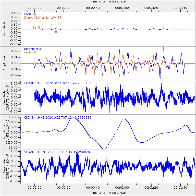
Signal To Noise
| Channel | StoN | STA | LTA |
| CI:DAN: :HHZ:20201023T07:15:49.258028Z | 1.0122145 | 1.0430301E-5 | 1.0304437E-5 |
| CI:DAN: :HHN:20201023T07:15:49.258028Z | 0.5765587 | 2.7930128E-7 | 4.8442814E-7 |
| CI:DAN: :HHE:20201023T07:15:49.258028Z | 1.4257661 | 4.566008E-7 | 3.2024943E-7 |
| Arrivals |
| Ps | |
| PpPs | |
| PsPs/PpSs | |


