You are here: Home > Network List > CI - Caltech Regional Seismic Network Stations List
> Station SWS Sam W. Stewart, Westmorland, CA, USA > Earthquake Result Viewer
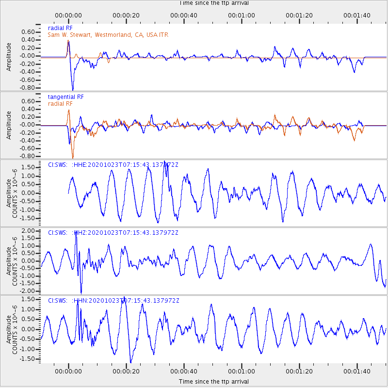
SWS Sam W. Stewart, Westmorland, CA, USA - Earthquake Result Viewer
*The percent match for this event was below the threshold and hence no stack was calculated.
| Earthquake location: |
South Of Fiji Islands |
| Earthquake latitude/longitude: |
-25.6/-180.0 |
| Earthquake time(UTC): |
2020/10/23 (297) 07:04:32 GMT |
| Earthquake Depth: |
464 km |
| Earthquake Magnitude: |
6.1 Mww |
| Earthquake Catalog/Contributor: |
NEIC PDE/us |
|
| Network: |
CI Caltech Regional Seismic Network |
| Station: |
SWS Sam W. Stewart, Westmorland, CA, USA |
| Lat/Lon: |
32.94 N/115.80 W |
| Elevation: |
140 m |
|
| Distance: |
84.4 deg |
| Az: |
49.512 deg |
| Baz: |
234.745 deg |
| Ray Param: |
$rayparam |
*The percent match for this event was below the threshold and hence was not used in the summary stack. |
|
| Radial Match: |
71.85113 % |
| Radial Bump: |
400 |
| Transverse Match: |
69.87375 % |
| Transverse Bump: |
368 |
| SOD ConfigId: |
22732711 |
| Insert Time: |
2020-11-06 07:15:47.941 +0000 |
| GWidth: |
2.5 |
| Max Bumps: |
400 |
| Tol: |
0.001 |
|
Signal To Noise
| Channel | StoN | STA | LTA |
| CI:SWS: :HHZ:20201023T07:15:43.137972Z | 2.426609 | 9.411356E-7 | 3.878398E-7 |
| CI:SWS: :HHN:20201023T07:15:43.137972Z | 1.6528177 | 6.1914494E-7 | 3.7459967E-7 |
| CI:SWS: :HHE:20201023T07:15:43.137972Z | 1.4857644 | 1.2237648E-6 | 8.236601E-7 |
| Arrivals |
| Ps | |
| PpPs | |
| PsPs/PpSs | |


