You are here: Home > Network List > US - United States National Seismic Network Stations List
> Station BOZ Bozeman, Montana, USA > Earthquake Result Viewer
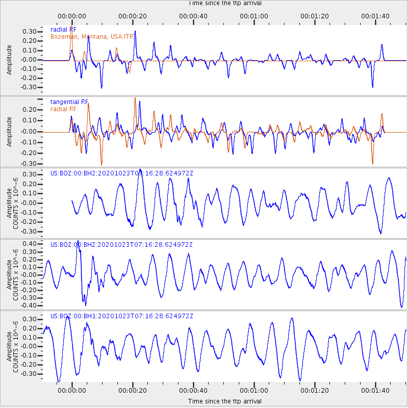
BOZ Bozeman, Montana, USA - Earthquake Result Viewer
*The percent match for this event was below the threshold and hence no stack was calculated.
| Earthquake location: |
South Of Fiji Islands |
| Earthquake latitude/longitude: |
-25.6/-180.0 |
| Earthquake time(UTC): |
2020/10/23 (297) 07:04:32 GMT |
| Earthquake Depth: |
464 km |
| Earthquake Magnitude: |
6.1 Mww |
| Earthquake Catalog/Contributor: |
NEIC PDE/us |
|
| Network: |
US United States National Seismic Network |
| Station: |
BOZ Bozeman, Montana, USA |
| Lat/Lon: |
45.65 N/111.63 W |
| Elevation: |
1589 m |
|
| Distance: |
94.2 deg |
| Az: |
40.817 deg |
| Baz: |
237.278 deg |
| Ray Param: |
$rayparam |
*The percent match for this event was below the threshold and hence was not used in the summary stack. |
|
| Radial Match: |
55.003494 % |
| Radial Bump: |
224 |
| Transverse Match: |
42.156704 % |
| Transverse Bump: |
312 |
| SOD ConfigId: |
22732711 |
| Insert Time: |
2020-11-06 07:23:14.644 +0000 |
| GWidth: |
2.5 |
| Max Bumps: |
400 |
| Tol: |
0.001 |
|
Signal To Noise
| Channel | StoN | STA | LTA |
| US:BOZ:00:BHZ:20201023T07:16:28.624972Z | 2.35564 | 2.514219E-7 | 1.06731896E-7 |
| US:BOZ:00:BH1:20201023T07:16:28.624972Z | 1.3932544 | 2.0932761E-7 | 1.5024364E-7 |
| US:BOZ:00:BH2:20201023T07:16:28.624972Z | 1.064856 | 1.4853443E-7 | 1.394878E-7 |
| Arrivals |
| Ps | |
| PpPs | |
| PsPs/PpSs | |


