You are here: Home > Network List > WY - Yellowstone Wyoming Seismic Network Stations List
> Station YHH Holmes Hill, YNP, WY, USA > Earthquake Result Viewer
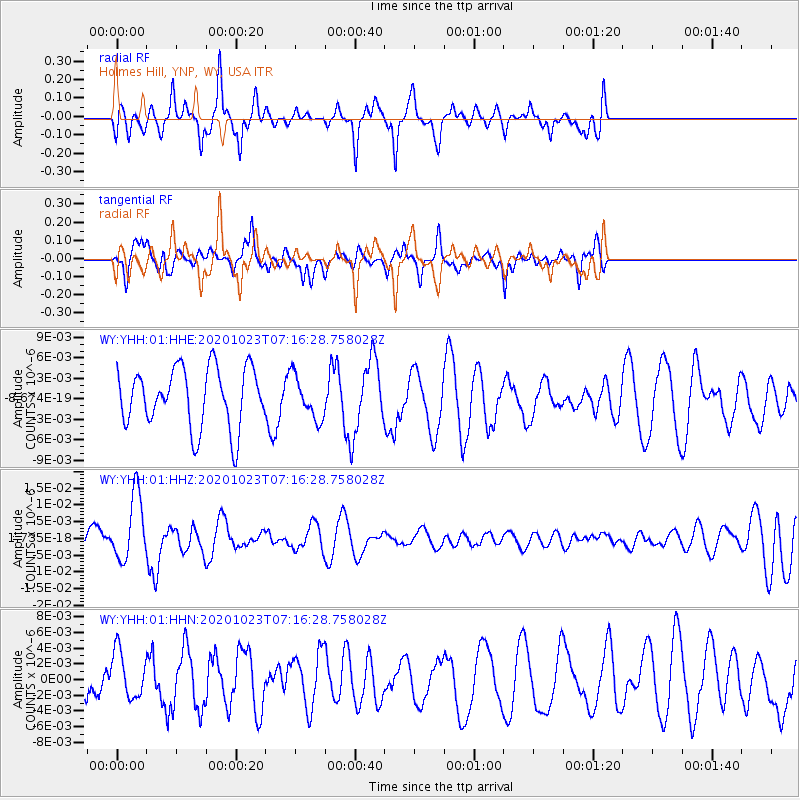
YHH Holmes Hill, YNP, WY, USA - Earthquake Result Viewer
*The percent match for this event was below the threshold and hence no stack was calculated.
| Earthquake location: |
South Of Fiji Islands |
| Earthquake latitude/longitude: |
-25.6/-180.0 |
| Earthquake time(UTC): |
2020/10/23 (297) 07:04:32 GMT |
| Earthquake Depth: |
464 km |
| Earthquake Magnitude: |
6.1 Mww |
| Earthquake Catalog/Contributor: |
NEIC PDE/us |
|
| Network: |
WY Yellowstone Wyoming Seismic Network |
| Station: |
YHH Holmes Hill, YNP, WY, USA |
| Lat/Lon: |
44.79 N/110.85 W |
| Elevation: |
2717 m |
|
| Distance: |
94.2 deg |
| Az: |
41.84 deg |
| Baz: |
237.755 deg |
| Ray Param: |
$rayparam |
*The percent match for this event was below the threshold and hence was not used in the summary stack. |
|
| Radial Match: |
42.976803 % |
| Radial Bump: |
305 |
| Transverse Match: |
52.298157 % |
| Transverse Bump: |
362 |
| SOD ConfigId: |
22732711 |
| Insert Time: |
2020-11-06 07:25:37.629 +0000 |
| GWidth: |
2.5 |
| Max Bumps: |
400 |
| Tol: |
0.001 |
|
Signal To Noise
| Channel | StoN | STA | LTA |
| WY:YHH:01:HHZ:20201023T07:16:28.758028Z | 3.3880856 | 1.0019813E-8 | 2.9573672E-9 |
| WY:YHH:01:HHN:20201023T07:16:28.758028Z | 1.2209063 | 3.0186338E-9 | 2.4724534E-9 |
| WY:YHH:01:HHE:20201023T07:16:28.758028Z | 0.72763574 | 3.168033E-9 | 4.353872E-9 |
| Arrivals |
| Ps | |
| PpPs | |
| PsPs/PpSs | |


