You are here: Home > Network List > CI - Caltech Regional Seismic Network Stations List
> Station MPM Manuel Prospect Mine, California, USA > Earthquake Result Viewer
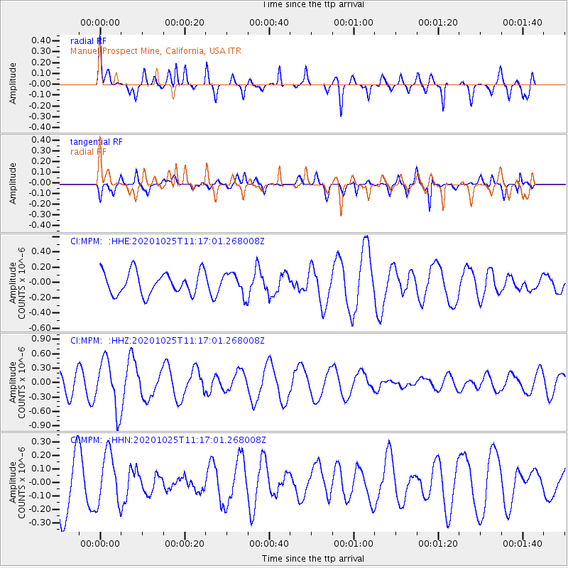
MPM Manuel Prospect Mine, California, USA - Earthquake Result Viewer
*The percent match for this event was below the threshold and hence no stack was calculated.
| Earthquake location: |
Solomon Islands |
| Earthquake latitude/longitude: |
-10.3/161.6 |
| Earthquake time(UTC): |
2020/10/25 (299) 11:04:46 GMT |
| Earthquake Depth: |
72 km |
| Earthquake Magnitude: |
5.2 Mww |
| Earthquake Catalog/Contributor: |
NEIC PDE/us |
|
| Network: |
CI Caltech Regional Seismic Network |
| Station: |
MPM Manuel Prospect Mine, California, USA |
| Lat/Lon: |
36.06 N/117.49 W |
| Elevation: |
185 m |
|
| Distance: |
88.8 deg |
| Az: |
53.166 deg |
| Baz: |
256.441 deg |
| Ray Param: |
$rayparam |
*The percent match for this event was below the threshold and hence was not used in the summary stack. |
|
| Radial Match: |
71.01804 % |
| Radial Bump: |
400 |
| Transverse Match: |
52.229237 % |
| Transverse Bump: |
400 |
| SOD ConfigId: |
22732711 |
| Insert Time: |
2020-11-08 11:10:12.864 +0000 |
| GWidth: |
2.5 |
| Max Bumps: |
400 |
| Tol: |
0.001 |
|
Signal To Noise
| Channel | StoN | STA | LTA |
| CI:MPM: :HHZ:20201025T11:17:01.268008Z | 2.8481321 | 5.310418E-7 | 1.8645265E-7 |
| CI:MPM: :HHN:20201025T11:17:01.268008Z | 1.0616332 | 1.9340142E-7 | 1.8217348E-7 |
| CI:MPM: :HHE:20201025T11:17:01.268008Z | 0.99761117 | 1.461014E-7 | 1.4645124E-7 |
| Arrivals |
| Ps | |
| PpPs | |
| PsPs/PpSs | |


