You are here: Home > Network List > US - United States National Seismic Network Stations List
> Station LAO LASA Array, Montana, USA > Earthquake Result Viewer
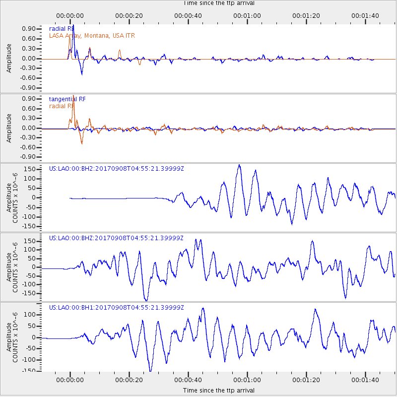
LAO LASA Array, Montana, USA - Earthquake Result Viewer
*The percent match for this event was below the threshold and hence no stack was calculated.
| Earthquake location: |
Near Coast Of Chiapas, Mexico |
| Earthquake latitude/longitude: |
15.1/-93.7 |
| Earthquake time(UTC): |
2017/09/08 (251) 04:49:21 GMT |
| Earthquake Depth: |
70 km |
| Earthquake Magnitude: |
8.1 Mww |
| Earthquake Catalog/Contributor: |
NEIC PDE/us |
|
| Network: |
US United States National Seismic Network |
| Station: |
LAO LASA Array, Montana, USA |
| Lat/Lon: |
46.69 N/106.22 W |
| Elevation: |
902 m |
|
| Distance: |
33.2 deg |
| Az: |
344.206 deg |
| Baz: |
157.545 deg |
| Ray Param: |
$rayparam |
*The percent match for this event was below the threshold and hence was not used in the summary stack. |
|
| Radial Match: |
96.66652 % |
| Radial Bump: |
253 |
| Transverse Match: |
75.81774 % |
| Transverse Bump: |
400 |
| SOD ConfigId: |
2307692 |
| Insert Time: |
2017-09-22 04:53:07.235 +0000 |
| GWidth: |
2.5 |
| Max Bumps: |
400 |
| Tol: |
0.001 |
|
Signal To Noise
| Channel | StoN | STA | LTA |
| US:LAO:00:BHZ:20170908T04:55:21.39999Z | 12.728057 | 1.4912757E-5 | 1.1716445E-6 |
| US:LAO:00:BH1:20170908T04:55:21.39999Z | 14.226033 | 6.392661E-6 | 4.4936357E-7 |
| US:LAO:00:BH2:20170908T04:55:21.39999Z | 10.405677 | 6.971497E-6 | 6.699705E-7 |
| Arrivals |
| Ps | |
| PpPs | |
| PsPs/PpSs | |


