You are here: Home > Network List > CI - Caltech Regional Seismic Network Stations List
> Station SMM Simmler, CA, USA > Earthquake Result Viewer
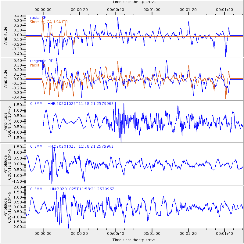
SMM Simmler, CA, USA - Earthquake Result Viewer
*The percent match for this event was below the threshold and hence no stack was calculated.
| Earthquake location: |
Tonga Islands |
| Earthquake latitude/longitude: |
-15.3/-173.3 |
| Earthquake time(UTC): |
2020/10/25 (299) 11:47:37 GMT |
| Earthquake Depth: |
44 km |
| Earthquake Magnitude: |
6.1 Mi |
| Earthquake Catalog/Contributor: |
NEIC PDE/pt |
|
| Network: |
CI Caltech Regional Seismic Network |
| Station: |
SMM Simmler, CA, USA |
| Lat/Lon: |
35.31 N/120.00 W |
| Elevation: |
599 m |
|
| Distance: |
71.3 deg |
| Az: |
43.833 deg |
| Baz: |
234.799 deg |
| Ray Param: |
$rayparam |
*The percent match for this event was below the threshold and hence was not used in the summary stack. |
|
| Radial Match: |
69.25682 % |
| Radial Bump: |
400 |
| Transverse Match: |
62.81976 % |
| Transverse Bump: |
400 |
| SOD ConfigId: |
22732711 |
| Insert Time: |
2020-11-08 11:55:30.747 +0000 |
| GWidth: |
2.5 |
| Max Bumps: |
400 |
| Tol: |
0.001 |
|
Signal To Noise
| Channel | StoN | STA | LTA |
| CI:SMM: :HHZ:20201025T11:58:21.257996Z | 1.2930872 | 5.691955E-7 | 4.4018336E-7 |
| CI:SMM: :HHN:20201025T11:58:21.257996Z | 0.53098667 | 2.9283123E-7 | 5.5148513E-7 |
| CI:SMM: :HHE:20201025T11:58:21.257996Z | 0.8864493 | 3.8919794E-7 | 4.3905268E-7 |
| Arrivals |
| Ps | |
| PpPs | |
| PsPs/PpSs | |


