You are here: Home > Network List > TA - USArray Transportable Network (new EarthScope stations) Stations List
> Station O17K Koliganek, Bristol Bay, AK, USA > Earthquake Result Viewer
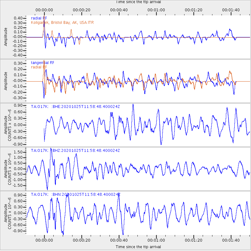
O17K Koliganek, Bristol Bay, AK, USA - Earthquake Result Viewer
*The percent match for this event was below the threshold and hence no stack was calculated.
| Earthquake location: |
Tonga Islands |
| Earthquake latitude/longitude: |
-15.3/-173.3 |
| Earthquake time(UTC): |
2020/10/25 (299) 11:47:37 GMT |
| Earthquake Depth: |
44 km |
| Earthquake Magnitude: |
6.1 Mi |
| Earthquake Catalog/Contributor: |
NEIC PDE/pt |
|
| Network: |
TA USArray Transportable Network (new EarthScope stations) |
| Station: |
O17K Koliganek, Bristol Bay, AK, USA |
| Lat/Lon: |
59.77 N/157.09 W |
| Elevation: |
156 m |
|
| Distance: |
76.0 deg |
| Az: |
8.393 deg |
| Baz: |
196.162 deg |
| Ray Param: |
$rayparam |
*The percent match for this event was below the threshold and hence was not used in the summary stack. |
|
| Radial Match: |
69.45602 % |
| Radial Bump: |
400 |
| Transverse Match: |
67.84022 % |
| Transverse Bump: |
400 |
| SOD ConfigId: |
22732711 |
| Insert Time: |
2020-11-08 12:03:47.311 +0000 |
| GWidth: |
2.5 |
| Max Bumps: |
400 |
| Tol: |
0.001 |
|
Signal To Noise
| Channel | StoN | STA | LTA |
| TA:O17K: :BHZ:20201025T11:58:48.400024Z | 2.4948072 | 1.040808E-6 | 4.1718977E-7 |
| TA:O17K: :BHN:20201025T11:58:48.400024Z | 1.6268331 | 4.939547E-7 | 3.0362963E-7 |
| TA:O17K: :BHE:20201025T11:58:48.400024Z | 1.1339337 | 2.4776674E-7 | 2.1850197E-7 |
| Arrivals |
| Ps | |
| PpPs | |
| PsPs/PpSs | |


