You are here: Home > Network List > US - United States National Seismic Network Stations List
> Station MIAR Mount Ida, Arkansas, USA > Earthquake Result Viewer
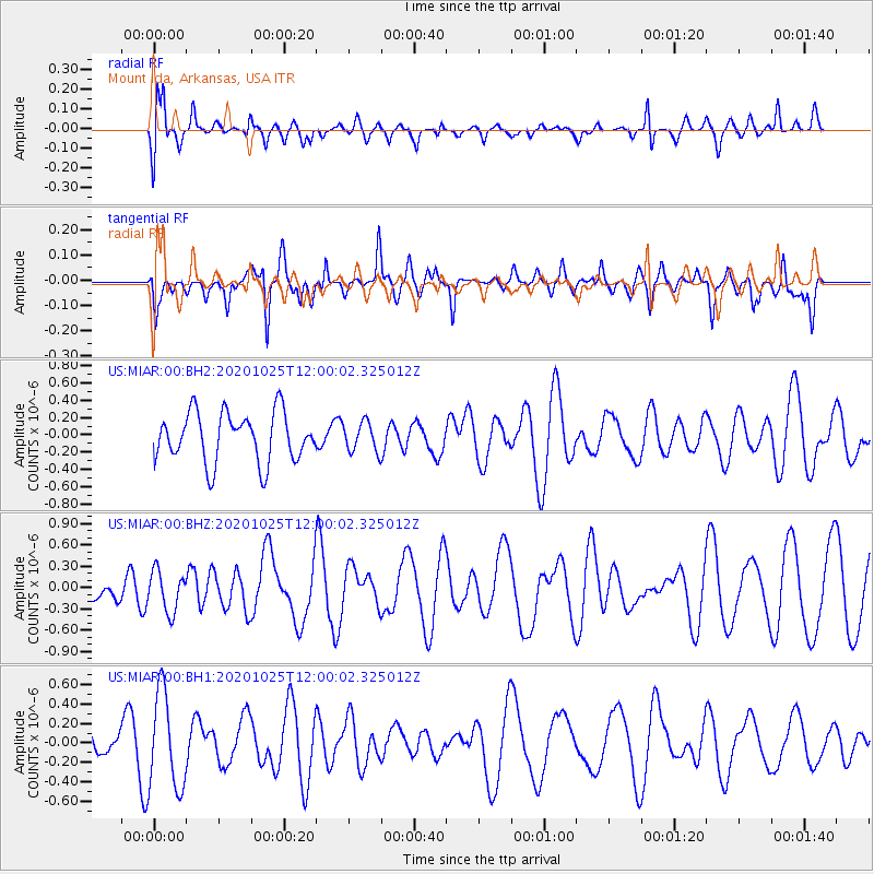
MIAR Mount Ida, Arkansas, USA - Earthquake Result Viewer
*The percent match for this event was below the threshold and hence no stack was calculated.
| Earthquake location: |
Tonga Islands |
| Earthquake latitude/longitude: |
-15.3/-173.3 |
| Earthquake time(UTC): |
2020/10/25 (299) 11:47:37 GMT |
| Earthquake Depth: |
44 km |
| Earthquake Magnitude: |
6.1 Mi |
| Earthquake Catalog/Contributor: |
NEIC PDE/pt |
|
| Network: |
US United States National Seismic Network |
| Station: |
MIAR Mount Ida, Arkansas, USA |
| Lat/Lon: |
34.55 N/93.58 W |
| Elevation: |
207 m |
|
| Distance: |
90.4 deg |
| Az: |
54.326 deg |
| Baz: |
251.735 deg |
| Ray Param: |
$rayparam |
*The percent match for this event was below the threshold and hence was not used in the summary stack. |
|
| Radial Match: |
77.37497 % |
| Radial Bump: |
400 |
| Transverse Match: |
58.893948 % |
| Transverse Bump: |
400 |
| SOD ConfigId: |
22732711 |
| Insert Time: |
2020-11-08 12:05:52.215 +0000 |
| GWidth: |
2.5 |
| Max Bumps: |
400 |
| Tol: |
0.001 |
|
Signal To Noise
| Channel | StoN | STA | LTA |
| US:MIAR:00:BHZ:20201025T12:00:02.325012Z | 0.7151026 | 2.853648E-7 | 3.9905433E-7 |
| US:MIAR:00:BH1:20201025T12:00:02.325012Z | 4.4585257 | 4.91509E-7 | 1.1024026E-7 |
| US:MIAR:00:BH2:20201025T12:00:02.325012Z | 0.59747785 | 1.7057847E-7 | 2.8549758E-7 |
| Arrivals |
| Ps | |
| PpPs | |
| PsPs/PpSs | |


